As of 12 Noon today (Friday): Winter Storm Warning is NOT for Cottage Grove, but it is for the surrounding hills/mountains above 1500'. So no need to worry for here in town. We can see a dusting or so Sunday night through about Monday mid-morning.
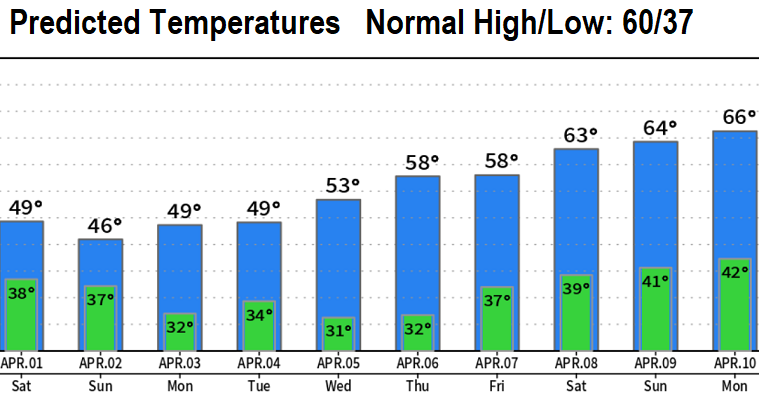
Three back-to-back storms will affect the region this afternoon through Tuesday, then it looks dry Wednesday through the Easter holiday weekend with a nice warming trend.
Storm #1 today (Friday): Rain will develop between about 3pm and 6pm. Heavy rain is expected from about 8pm this evening to 8am Saturday with 3/4-1" of rainfall just during this time period. Winds can gust up to 25 mph at times.
Saturday through Tuesday: Periods of rain/showers as the remaining two storms affect the area. Total additional rainfall Sat-Tue up to another 1". Winds can gust up to 25 mph through Sunday, then will be 15mph or less Mon/Tue.
SNOW LEVELS will gradually lower from 3000' today to 2000' on Saturday, then will further lower on Sunday to about 500' Sun night. Monday morning, snow levels of 500' will then rise to 1000-2000' for the rest of the day and through Tuesday. Heavy snow is likely above 2000' where up to two feet is possible through Tuesday.
Looking dry with a nice warming trend (right now) Wednesday through Easter Sunday (Apr 9). Highs may be 65-70 on Easter!
Next email update will be on Sunday.