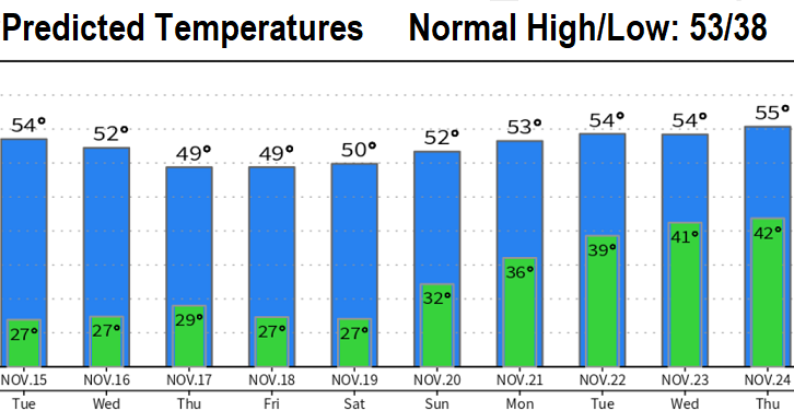
Monday Weather Update: Cold nights with below freezing lows will continue through Saturday. Varying amounts of night/morning fog and cloudiness.
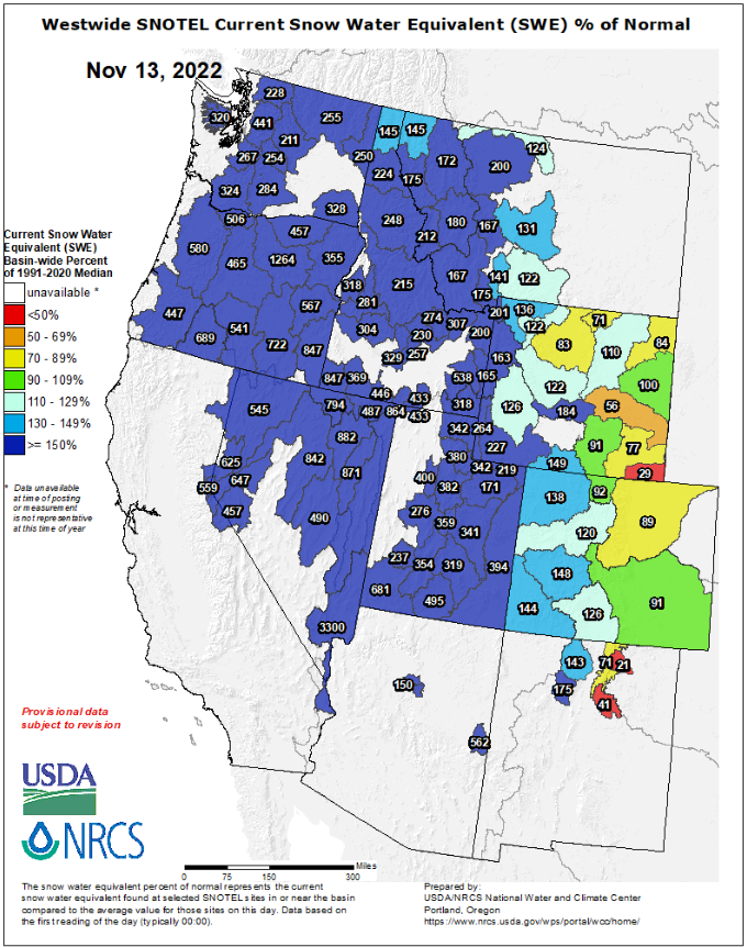
As it looks right now, no signs of *significant* precipitation through the day before Thanksgiving (Wed Nov 23). Although a storm system *may* pass through next Monday, a more consistently wet pattern may develop on Thanksgiving Day or during the holiday weekend. The good news is that the snow pack is way above normal for this time of year and drought numbers have improved a little over the past 10 days (see one of my recent posts about this).
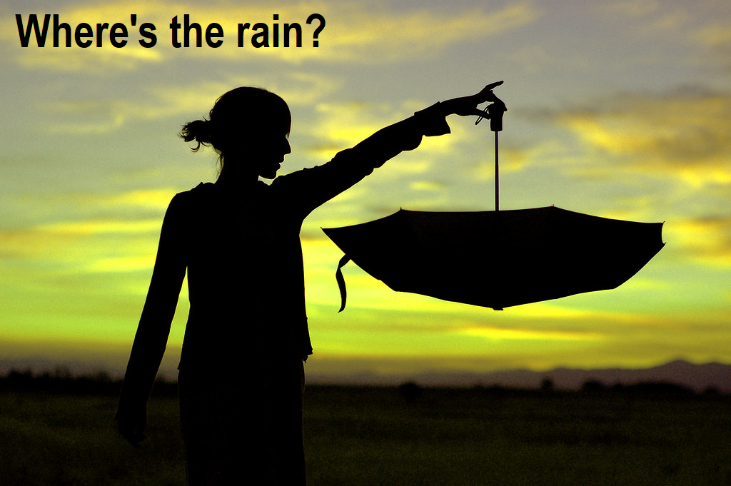
Why are we so dry? Lots of anomalous and strong high pressure in the North Pacific and western U.S. is the sole culprit for our dry Autumn (so far). This is a pattern that has occurred, at times, since 2012 and is a major reason why California and parts of the southwest have been in a mega drought. I'm concerned about the vastness of high pressure, which is blocking storms from otherwise bringing us much needed rain and snow. However, that's not to say that this pattern won't break down and we end up with good precipitation winter / spring. Note that La Nina conditions are present and during a La Nina, it's typical for stubborn high pressure to be present in certain parts of the North Pacific (but certainly not as widespread and vastness that we're seeing now).You may have seen the study as to what's happening with our weather patterns: Study: Temperature and Precipitation Trends - Cottage Grove Weather (grovewx.com)
Will it be a cold winter? Yup, just like every other winter...no 100 degree temps for Christmas this year!