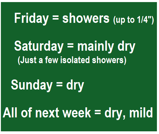
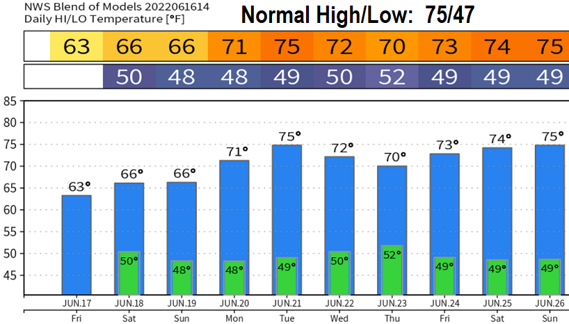
Thursday June 16: Hope you're all doing well! Showers on Friday (up to 1/4"), Saturday looks mainly dry (just a few isolated light showers), then dry Sunday through possibly the end of the month. No heatwave in sight, high temps cooler than normal through Sunday (60's), then near normal temperatures all of next week (70's). Remember last year on June 27 we hit 108° ©. I put the copyright © symbol so Mother Nature can't repeat last year's record heat.
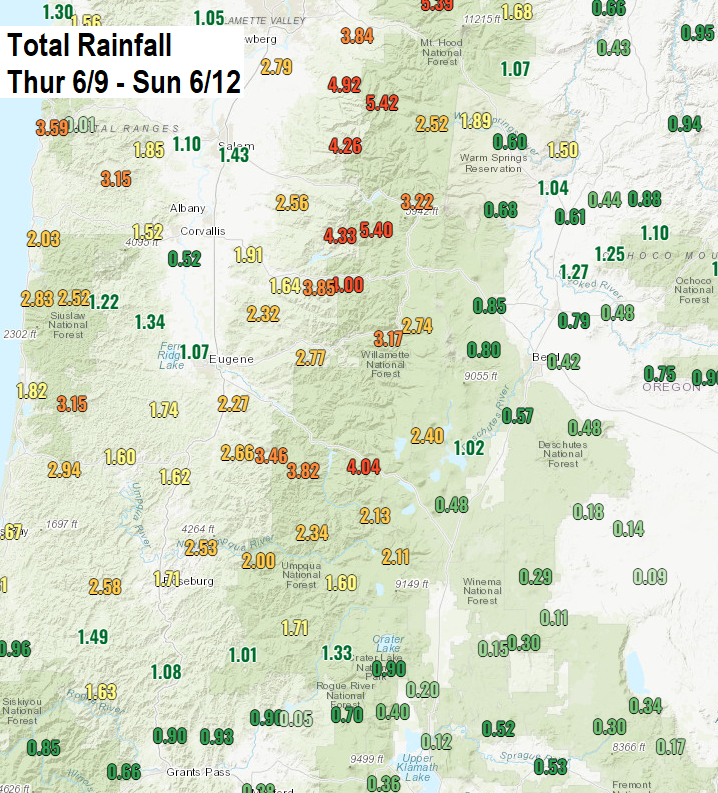
Reservoirs are full with water overflowing the spillways because of the warm "tropical" air mass we had last Thursday-Sunday. This resulted in excessive rainfall and warm temps which accelerated snow melt. Check out the map which shows observed rainfall last Thursday through Sunday. Rivers are running high and fast. Even though it may look calm, the currents below are strong and swift. If venturing near rivers, be mindful that it's extremely easy to succumb to the river's current. Good idea to stay out of the water for now.