
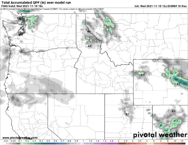
Over the past day or so you've probably come across headlines of "heavy rain expected" and/or "hydrologic outlook." This is because a storm system will direct a narrow plume of moisture into the Pacific Northwest for an extended period of time, resulting in areas of heavy rain, potential for flooding, and mudflow possibilities around some of the burn areas. These types of systems are very complex and impossible to predict exactly where the north and south heaviest rainfall boundaries will be. Since the moisture plume is narrow, just a small 25-mile shift north or south results in more or less rainfall at the northern and southern edges. Initially through Thursday, our area will be on the southern edge of the moisture plume. As of this writing, the bulk of the moisture and heaviest rains will be directed north of us (into SW Washington and Salem north). Therefore, light to moderate rain is expected for the Cottage Grove area. Remember, any shift north or south of the main narrow moisture band will affect predicted rain totals. This image shows model-predicted accumulated rainfall. Notice the heaviest rain occurs north of our area.
What: Periods of rain through Friday night with high snow levels above 8000'. Maybe a rumble of thunder. Humid.
Timing: Rain is expected to develop at some point this afternoon, most likely between 3pm and 6pm. Periods of rain will then continue through Friday night.
Hazards: Heaviest rain is expected to stay north of our area. However, as stated above, any shift of the moisture plume could result in heavier rain across our area.
Total Rainfall: Expect 1/2"-1" through Friday night. If the moisture band shifts more to the south, rainfall totals will be higher. Total average rainfall for the month of November is 6.92". As of 10:00am today (Wed Nov 10), we've recorded 2.33" so far this month and 6.88" since the start of the water year on Oct 1.
Wind: No wind concerns. Southerly breezes at times are expected to stay under 15 mph.
Temperatures (5-days): Mild highs and lows through Friday. Highs 55-60 today (Wednesday), then 59-64 on Thursday and Friday. Lows will be 49-54. Normal high/low is near 54/38.
Fog: Patchy fog possible at times. Saturday and Sunday will likely have night/morning fog.
Snow Potential below 1000': Not going to happen.
Frost/Ice probability: Widespread frost, freezing temperatures, icy roads are not expected through Monday. Tuesday night through the middle of next week, lows may be in the low to mid 30's.
15-day Outlook: With the weekend looking dry, another storm will bring rain to the area on Monday (Nov 15). Tuesday night and the rest of next week is then expected to be dry. In fact, there's strong indications that we may have an extended period of dry weather through the days leading up to Thanksgiving, or possibly into Thanksgiving day (Nov 25). If data continues to hint at this, it would be highly unusual. After lows in the low-mid 30's during the middle of next week, temperatures rebound closer to normal at the end of next week.
Seasonal Outlook (90-days, preliminary): Slightly better chances for above average precipitation, good chances for slightly below normal temperatures for December.