Warmer today / Monday, then a little cooler. Rain next weekend?
June 11, 2023
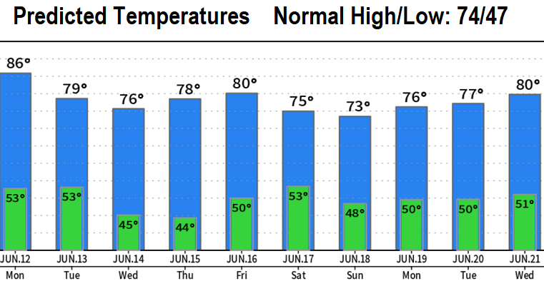
Warming trend continues today (highs low 80's) and Monday (highs mid 80's). Normal high is 74°.
Highs then cool and should hover around the mid 70's to about 80 Tuesday through Friday.
Next weekend is looking cooler, as a couple of weak low pressure systems pass through the PacNW and bring us some clouds and cooler air. We may get a couple of showers out of thiese systems, but steady rain looks unlikely right now. No excessive heat seen through the end of June.
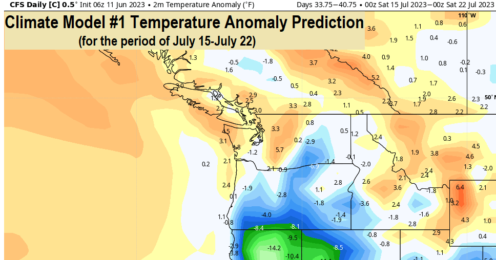
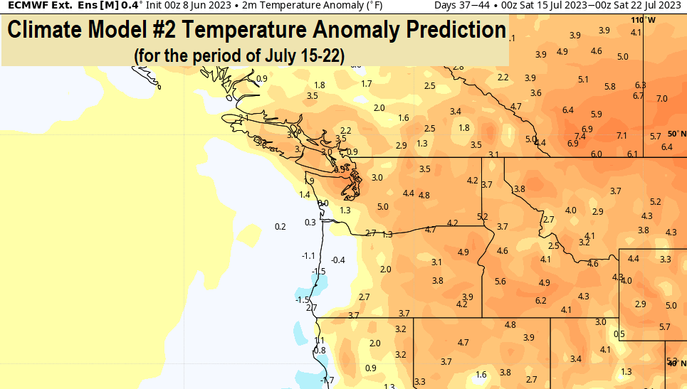
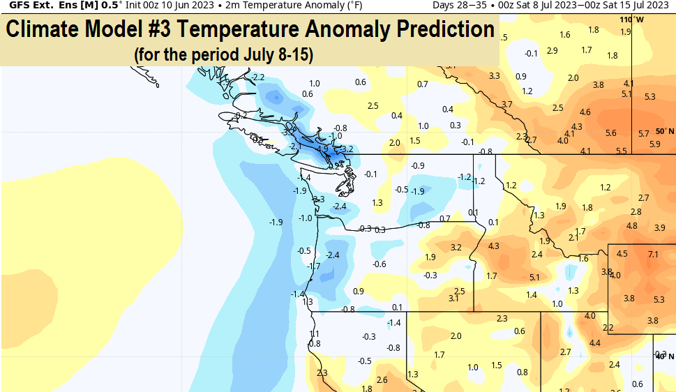
July heat? As of right now, preliminary outlooks for July put odds at near normal temperatures. In fact, about half of the long range data indicates that the first part of July will have below normal temperatures (as a whole, combining highs/lows). This doesn't mean that we we're exempt from a heatwave, but rather that the chances of July being excessively hot are extremely low.
Check out the images below from a few of the climate models. These are temperature anomaly predictions for around the middle of July. While Meteorologists don't exclusively rely on models for official forecasts, we use them as a forecast aid. Models aren't 100% accurate. Accuracy with the models vary based on the weather patterns in place. Some models do a better job at predictions during certain weather patterns than others, so it's important to have an understanding of model bias (which takes Meteorologists many years to learn these biases).
Subscribe to receive updates when we post weather and preparedness updates to our blog. You can elect immediate, daily, or weekly emails. We anticipate a fairly low volume - 3 to 5 posts per week.