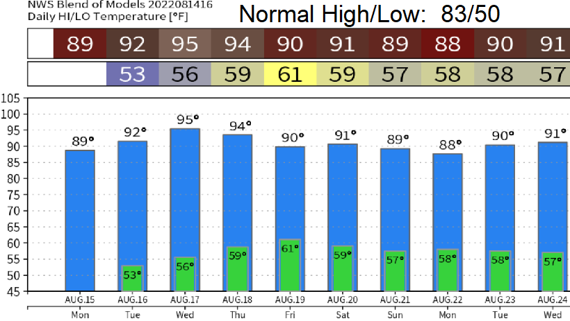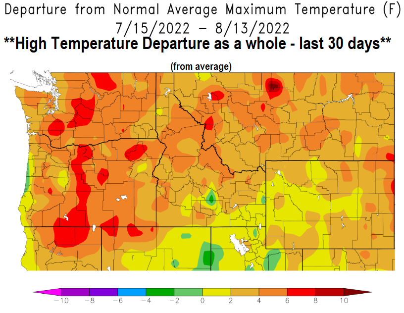
Sunday: High temps have been warm over the past 30 days, check out the image! Local fire danger continues to be high. High temperatures will warm a little today and Monday as high pressure to our east / southeast builds northwest / westward into our region. This will cause the general wind flow to start blowing from a southerly direction. We should start to notice an increase in humidity on Monday and Tuesday. Wednesday and Thursday, western high pressure becomes strong and our high temperatures will push into the mid 90's (normal high is 83).
Friday or Saturday: High pressure will back off some and our high temps will likely drop to somewhere between 85-90, possibly lower. A low pressure system may develop offshore on Friday and stick around through next weekend. We'll have to watch this because it "may" help draw up some monsoon moisture into the region due to the southerly flow. If this happens, thunderstorm chances would increase and it'll be humid/muggy (possibly as early as Saturday and may continue into the following week). Look for an update about this on Tuesday or Wednesday.
End of August (around Aug 29): Better probabilities for low pressure systems from the north to start pushing closer to our area and kick high pressure out of the way. If this happens as models suggest, the pattern would be more typical (and seasonably cooler) for this time of year.