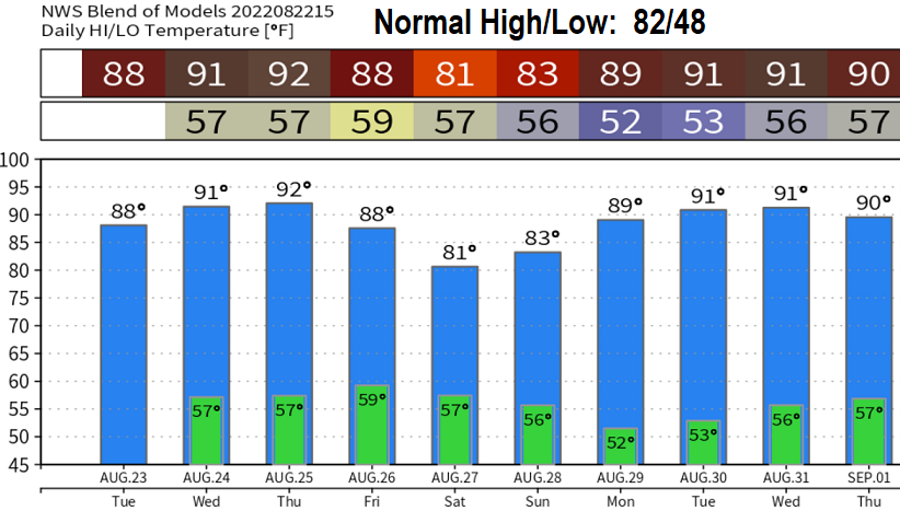
Monday: Whose ready for fall or at least near average temperatures? Above average temperatures are expected to continue over the next 7-10 days. No signs of meaningful rain, either. The pattern may change a little at the end of the month, but reliable data favors a mainly dry pattern with above normal temperatures through September 7. Normal high/low right now is 82/48
Anomalously strong high pressure in the North Pacific is the main culprit for our hot and dry weather. It's generally been keeping the storm track aimed well north of us, despite a few low pressure systems that have been strong enough to weaken the high pressure at times (causing a few cool days here and there).
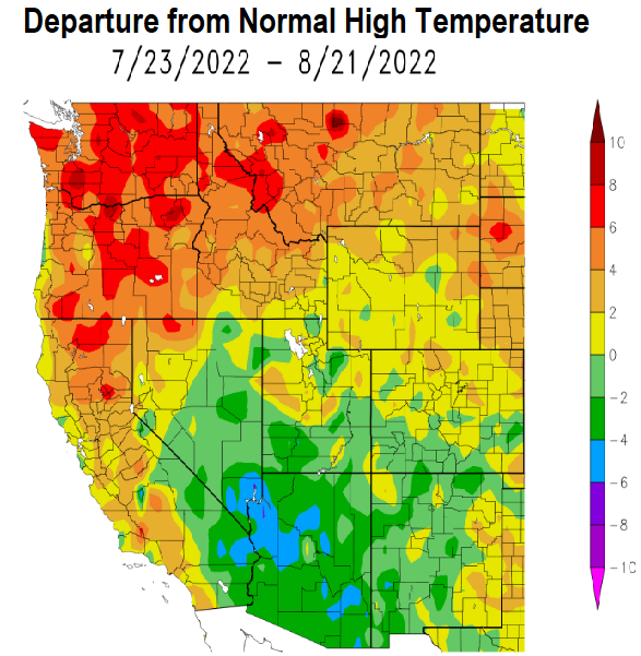
Below, check out the 10-day model predicted temperatures. Also take a look at the departure from normal high temperatures over the past 30 days. Humidity has also been elevated over the past 30 days. Since June 1, we've had 24 days of high temps at or above 90°.
Fire danger rating continues to be high across our area. Sunset is at 8:07pm tonight. Friday will be the last day of sunsets in the 8 o'clock hour (8:00pm). On Saturday, the sunset is at 7:58pm.