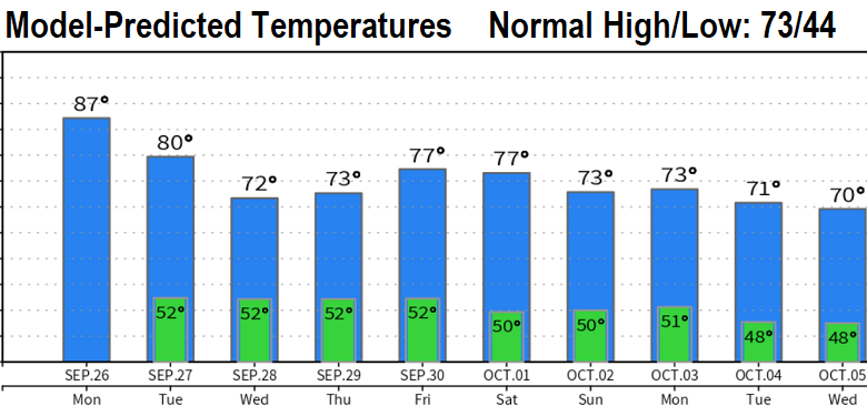
Want rain? Other than isolated to possibly light scattered showers on Wednesday into Thursday morning, dry weather will prevail through next weekend. Warm/Hot today and Monday, then a nice cooling trend.
Winds will vary in direction through Tuesday which will allow smoke to get into our area from the Cedar Creek Fire. Air quality will likely stay in the "Moderate" category, but could push into "Unhealthy for Sensitive Groups" at times. The weak storm system on Wednesday should switch the wind direction to blow from the south and clear out much of the smoke - if all goes according to plan.
Things then get interesting, with an expected rainy pattern developing, starting Monday or Tuesday (Oct 3, 4). I should note that we'll have to watch what will soon be Hurricane Ian in the Gulf of Mexico. Ian will pound into the Florida panhandle on Thursday night or Friday morning. The reason to keep an eye on it is because it could backup the flow out west, depending on the track of the system and if it stalls anywhere after landfall.
Outlooks for October (and beyond) continue to indicate better odds for above normal precipitation as La Nina continues for a third year.