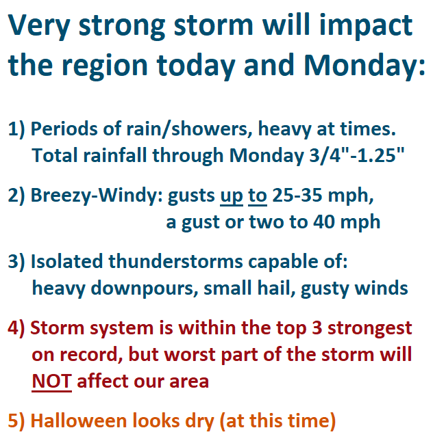
Although this storm system is within the top 3 strongest on record, it's beginning to slowly weaken. The worst part will not affect our area, since the main low pressure center is about 400-500 miles NW of us (as of 10am Sunday).
Periods of rain/showers, possibly heavy at times, can be expected through Monday. It will be breezy to windy at times, with gusts up to 25-35 mph. A few gusts to 40 mph cannot be ruled out. Isolated thunderstorms are possible and capable of causing gusty winds, small hail, and brief heavy downpours. Total rainfall through Monday is expected to be 3/4"-1.25".
Periods of rain/showers will continue on Tuesday. Wednesday and Thursday may end up being mostly dry, but there's some uncertainty right now. Another system (weak) may pass through later Friday into Saturday (emphasis on "may"). Halloween (Sun Oct 31) is looking dry.
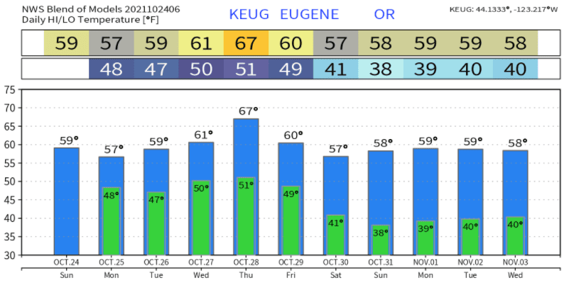
Temperatures look like this over the next 10-days: