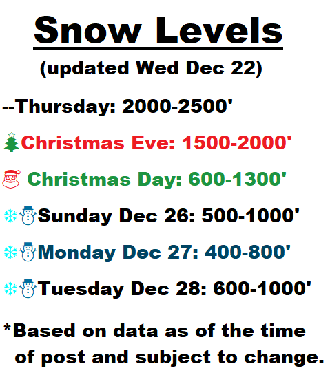
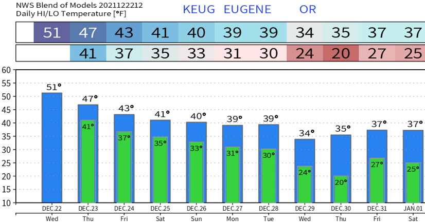
Wed Dec 22 SNOW UPDATE: Little change in predicted snow levels. Based on current data, odds lean towards some snow or at least a rain/snow mix anytime from early Christmas morning through Tuesday. Highest probabilities at this time look to be Saturday night through Sunday evening. Most data hint that we can see a dusting to 5", with some models as high as 8" or 9". We may also have another chance at snow on Tuesday and New Year's Eve. Temperatures will start the downward spiral tomorrow and be downright cold next week, when lows of 18-22 are possible as early as Wednesday morning Dec 29. Temperatures will likely stay far below normal through the first week of the new year. Check out the predicted temperatures next week.
WINDS: Some southerly breezes to 15 mph possible through tomorrow, then up to 25 mph on Christmas Eve (Friday) and 15-20 mph on Christmas Day.