
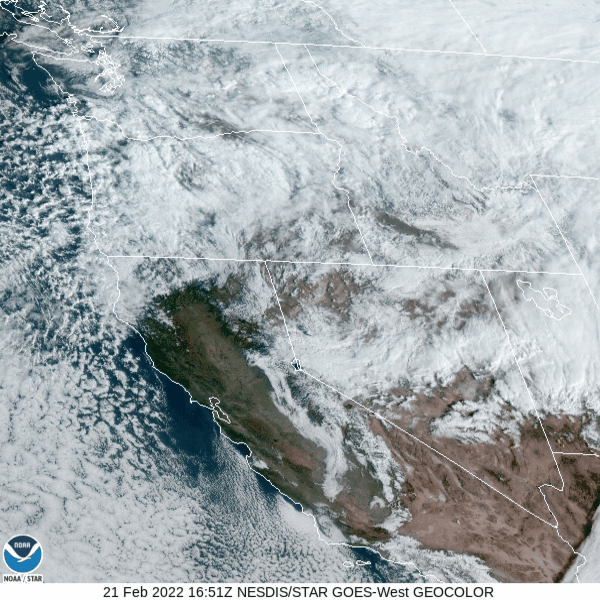
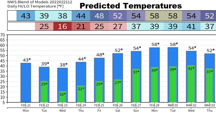
Monday Feb 21: Check out the satellite image - those speckled clouds moving into Oregon are indicative of very cold air. Modified Arctic air will continue moving into the region through Tuesday night. High temps upper 30's-low 40's through Wednesday. Lows tonight 25, Tuesday night 15-18, Wednesday night 20, Thursday night 25. This is way too cold for animals. Breezy at times through tonight, winds less than 20 mph. Winds on Tuesday can gust up to 15-25 mph, including at night. Dogs/cats/pets cannot maintain their warmth in these temperatures and wind, unless inside.
SNOW: Best chances are later this afternoon to about 2:00am. Some of the showers could cause some flurries or a very light rain/snow mix. A light dusting is also possible, mainly after 7pm, but by this time there'll only be very little moisture left with the storm so odds are low but not zero.
Next chance of rain looks to be Sunday morning through Wednesday of next week from two storm systems. Still too early to say with certainty, but there's hints that these systems may drop an inch or so of rain.