Update on Freezing Rain / Snow Tonight-Thursday...
February 12, 2025
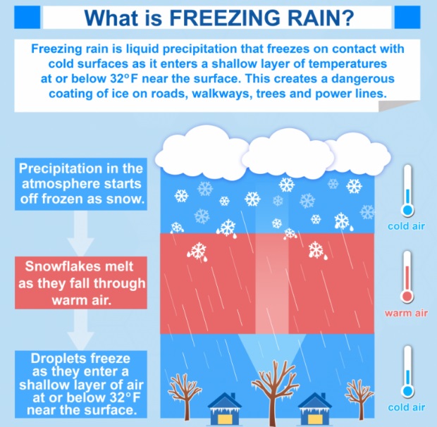
UPDATE ON FREEZING RAIN & SNOW POTENTIAL: RIGHT NOW still looks like freezing rain remains possible anytime between 11:00pm tonight and 8:00am Thursday morning.
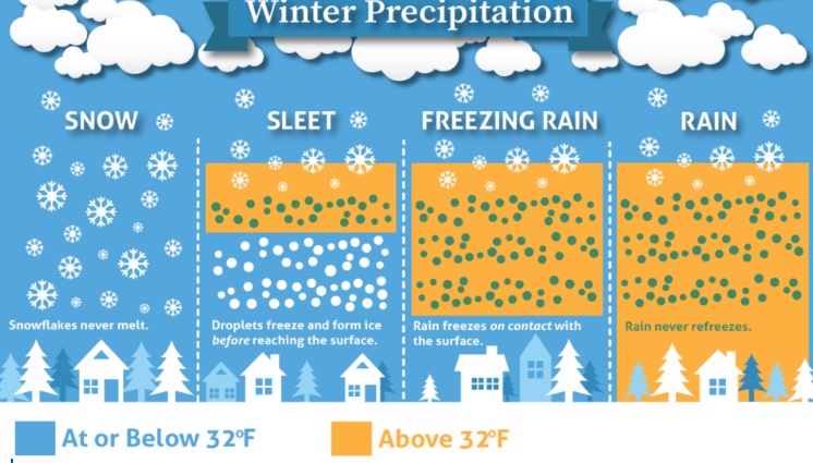
Bullseye period for Freezing Rain is 1:00am-6:00am and could see around 1/4-1/2" total ice accumulation.
SNOW: Can't rule out a very light dusting of snow Thursday morning, but everything right now points towards Freezing Rain due to how the temperatures in the atmosphere look.
Precipitation will be coming in from the south / southwest (during winter rain typically moves in from the west/northwest).
STRONG WINDS not expected.
FREEZING TEMPERATURES: 32° or below anytime after about 7:00pm then should rise to above freezing by about 8:00am Thursday; any ice / snow will then start to slowly melt.
After around 8:00am Thursday, rain will be the name of the game (can't say 100% no to a rain/snow mix until 9am-ish). But definitely after 10am temps will be too warm for anything other than rain.
COLD TEMPERATURES: Tonight is currently expected to be the last day of the ridiculous cold. Then through the end of the month we may only have just a day or two of lows near freezing. Normal high/low is 53/34 and Saturday through possibly the end of the month we may see temps at or a hair above normal (keep fingers crossed).
KEEP IN MIND that when dealing with winter weather, predictions can change in the blink of an eye.
ICY & SLIPPERY ROADS/SIDEWALKS likely tonight through 9am Thursday.
Subscribe to receive updates when we post weather and preparedness updates to our blog. You can elect immediate, daily, or weekly emails. We anticipate a fairly low volume - 3 to 5 posts per week.