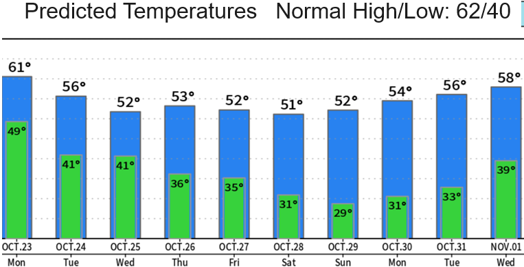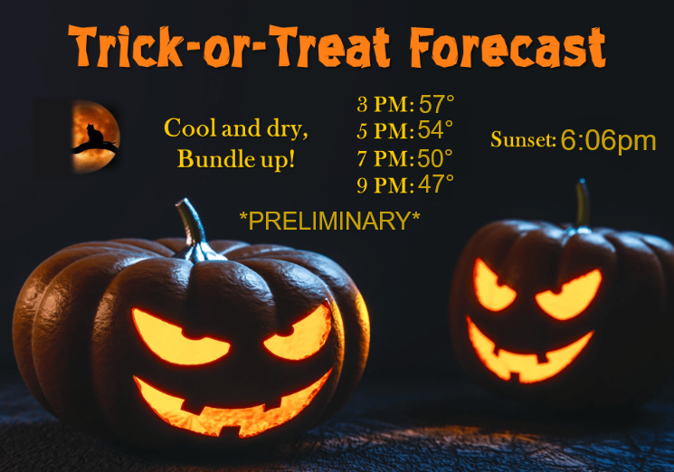
SUNDAY WEATHER UPDATE: Much colder beginning the middle of the week; first frost of the season likely Thursday morning. Freezing lows probable Friday night through next weekend. Lowest snow levels of the season so far Tuesday onward. Halloween looks dry right now (small chance this may change); it'll also be cold during Trick-or-Treat time.
Coldest low pressure system of the fall season (so far) is expected to affect the region Tuesday and Wednesday with snow levels down to 4000'. Here, expect around 1/2" of total rainfall (Tue+Wed). No wind concerns as gusts look to be 20 mph or less.
Right now it's looking like Thursday and Friday may have a few isolated showers, but cold air will continue to filter in. Lows Friday night through next weekend will probably be around freezing. At this time it looks dry Saturday through Halloween.
CLOCKS GO BACK ONE HOUR at 2:00am on Sunday November 5. Sunset Nov 4: 6:00pm, Sunset Nov 5: 4:59pm.