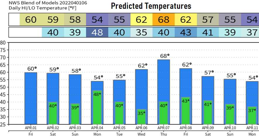
Friday April 1: I took a little trip to Reno, so didn't post anything over the past week. Saw very little snow over our local passes. There'll be isolated to scattered light showers across the area between 6pm this evening and 3am Saturday, then dry the rest of Saturday through Sunday afternoon. Normal high/low temperature: 60/37.
Next storm brings rain to the area after 7:00pm Sunday through Monday. This will be a windy storm with gusts up to 25-30 mph Sunday afternoon through Monday evening. Snow levels 3500-4500'. Total rainfall 1/2-3/4". Showers may linger into Tuesday morning, then it looks dry through Friday. Another system may bring showers to the area late next weekend (Sun Apr 10). Some signals that several storm systems may then continue to affect the region through around April 20. Of course this is preliminary, so let's keep our fingers crossed.
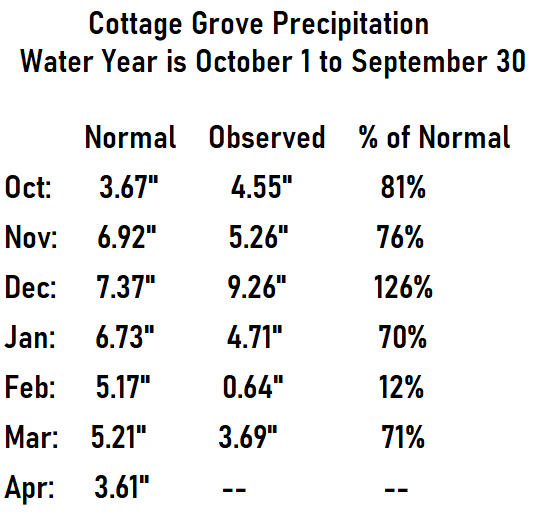
Precipitation: As you know, Oct-Dec had above normal rainfall, then the faucet got turned off in January. Had we had at least normal rainfall Jan-Mar, our drought would have ended and we'd be sitting in a really good position. Unfortunately, that wasn't the case due to anomalously strong, blocking high pressure in the eastern North Pacific Ocean pushing the jet stream (and storm systems) well north into Canada. Check out the monthly percentages of normal in the image.
Since the start of the water year on Oct 1, 2021, we've recorded 28.12" of precipitation in Cottage Grove. Normal to date is 35.07". Our region of the snow pack is 65% of average; statewide average is 52%.
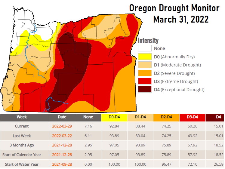
Drought: Not good news. Our wettest months are now behind us - 88% of Oregon is in a drought. It's extremely unlikely that we'll see any further improvement which means we'll be walking into summer with pretty significant drought conditions.
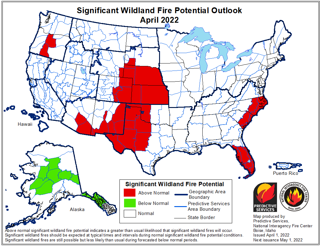
Fire Danger: April has above normal potential for significant wildland fires in a portion if central Oregon (east of our area). Don't panic for our local area, since other components come into play with the fire danger here. If we get some light showers at times during the summer months, that can help reduce the local fire danger. Also, if summer is dominated by an "onshore flow" (where winds generally blow from sea onto land), that can help increase local humidity levels and somewhat reduce the fire danger. Winds blowing from the east dry things out whereas winds that blow from the west bring in more moisture from the ocean.
