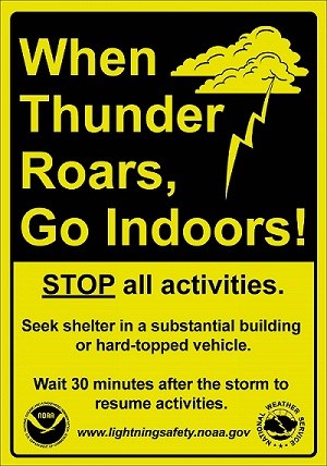
No need to worry; let's talk sense and perspective:
Isolated to possibly scattered thunderstorms expected Wednesday, very isolated thunderstorms Thursday.
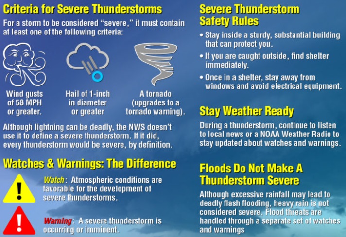
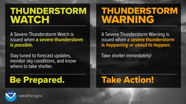
Under the right circumstances, a few thunderstorms on Wednesday have a very small risk of becoming "severe." Severe thunderstorms, by definition: capable of producing 58 mph or greater winds, 1" or larger hail, funnel cloud or brief tornado. In the entire U.S., just 5% of thunderstorms become severe and of all "severe" thunderstorms, 1% produce a tornado. A "supercell thunderstorm" (very very very rare in Oregon, more common east of Rockies), only makeup a small percentage of "severe" thunderstorms, historically produce a tornado about 20% of the time. The majority of severe thunderstorms have strong wind gusts with small to medium sized hail.
Greatest risk for a "severe" thunderstorm is Wednesday 1:00pm-5:00pm and mainly within the Willamette Valley (including Cottage Grove).
There is no way to predict exactly where thunderstorms will form. Putting things into perspective, there's about a 20-40% chance of a thunderstorm occurring within 25 miles of any one point on Wednesday. Within this, the severe thunderstorm risk of 1" or larger hail is 15% within 25-miles of any point and just a 2% risk of a small tornado within 25-miles of any point.
Total combined rainfall Wed-Thur (via showers) is less than 1/2" (higher if t-storm). Winds under 20 mph Wednesday (stronger gusts if t-storm) then 15-30 mph Thursday.
Friday will have around 1/2" of rain/showers and 15-30 mph wind gusts.
Subscribe to receive updates when we post weather and preparedness updates to our blog. You can elect immediate, daily, or weekly emails. We anticipate a fairly low volume - 3 to 5 posts per week.