Happy May 1st! Three storms over the next 7-days will drop up to 2.50" of total rainfall. Bulk of rain occurs 5:00pm Friday to 4:00pm Saturday as a moderate strength storm affects the state. Snow levels will vary mostly between 4000-6500', but could dip to 3500' at times. A small chance of a thunderstorm will also exist.
Storm #1 (weak) moves in later this evening through Thursday morning, 0.20-0.30" of rain, wind gusts 15 mph or less. Storm #2 (moderate) arrives late Friday morning or early afternoon and exists Sunday afternoon, 1-2" of rain, wind gusts 25 mph or less. Storm #3 (weak) arrives Monday morning and exits Tuesday morning, 0.10-0.20" of showers, wind gusts 10 mph or less. Next Wednesday (May 8) a weak storm may pass through, but strong high pressure may beat it and build in. In any case (at this time), strong high pressure is expected Friday May 10 through Wednesday May 15.
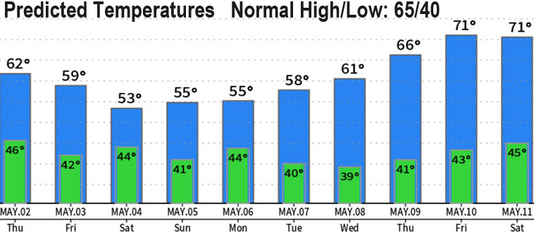
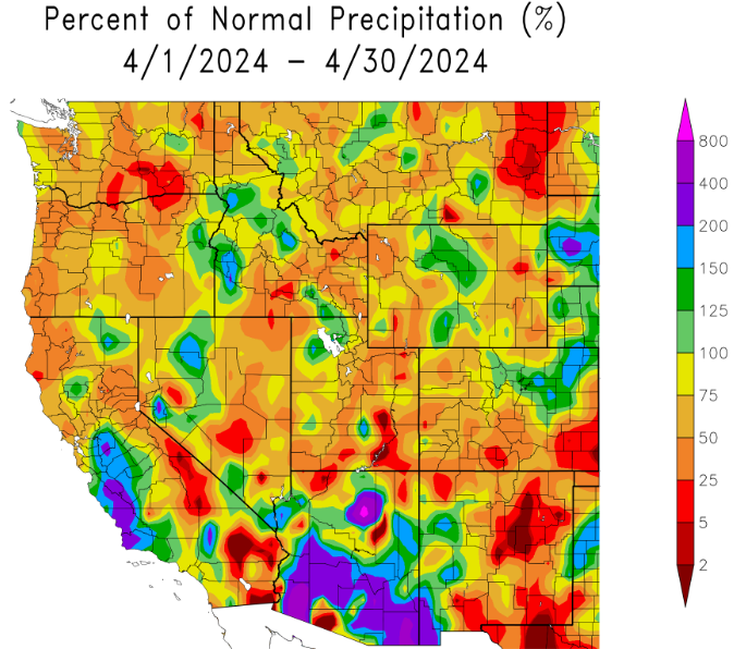
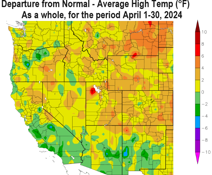
Scroll down and check out how the month of April did with high/low temps and precipitation as a whole. Also notice the nice warm-up later next week in the predicted 10-day temperature chart.