If you're traveling during the Thanksgiving holiday period next week, no major weather impacts are expected through Saturday morning Nov 27. See below for later Sat Nov 27 and Sun Nov 28.
This afternoon through Friday: A low pressure system will bring periods of mainly light rain and showers to the area through Friday afternoon or early evening. Total rainfall from this system today and Friday looks to be 1/4"-1/2". It can get breezy at times later this afternoon or evening to about sunrise on Friday, with some wind gusts of 15 or 20 mph.
Friday night through the weekend: Looks dry, but low temperatures are expected to be around 30-35 (especially Saturday night and again Sunday night). Therefore, expect frosty mornings on Sunday and possibly Monday with some patches of ice possible on the roads (esp bridges). Some data hints that there could be some cloud cover overnight which could cause lows to be a little higher than forecast.
TRAVEL WEATHER NEXT WEEK: At this time, no major issues are expected through Thanksgiving Day. A couple of low pressure systems will bring regional rain and small amounts of snow (mainly above 5000-6000') later Tuesday into Wednesday morning. Major winter weather impacts are not expected through Saturday morning (Nov 27) over the Cascades and WA/OR + CA/OR border passes.
Thanksgiving day (Thur Nov 25) & Fri Nov 26: A storm system will bring rain and a small amount of higher elevation snow. Showers may continue into Friday (Nov 26). This doesn't look to be a particularly cold system, so all Oregon passes are not expected to have significant winter weather impacts (at this time).
Saturday Nov 27: A storm system may pass through with rain and high elevation snow (mostly above pass levels, no major winter weather impacts expected at this time).
Sunday Nov 28: A storm system with significant winter weather impacts may affect the PacNW. Note that there's large differences with the computer models right now, which should be resolved over the next few days. On or before Monday, I should have a better grip on this potentially powerful system that could impact return travel (or not).
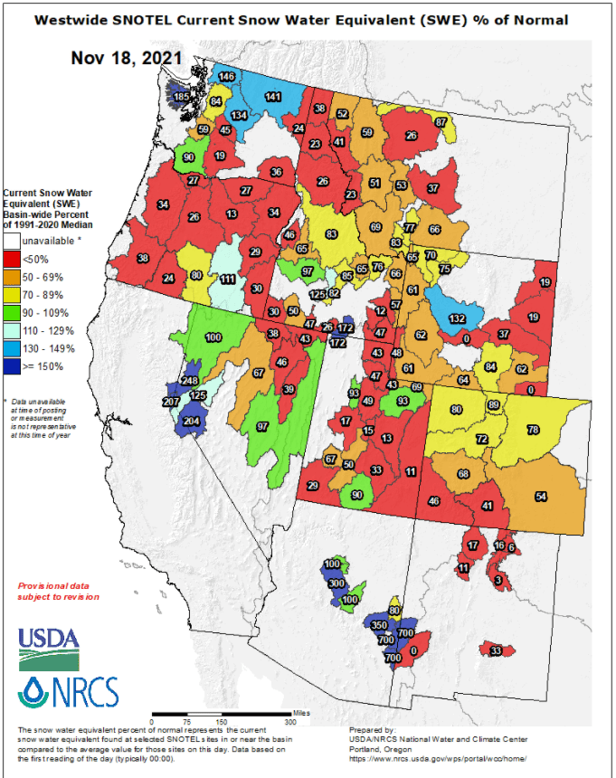
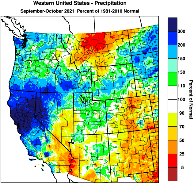
Precipitation to date: As of 11:00am Thurs Nov 18, we've recorded 9.08" of rainfall since the start of the water year on October 1. So far for November, we've observed 4.53". Normal for the entire month is 6.92". Scroll below to see precipitation information, including snow pack.
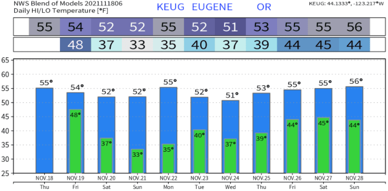
Temperatures look like this over the next 10-days (not set in stone):