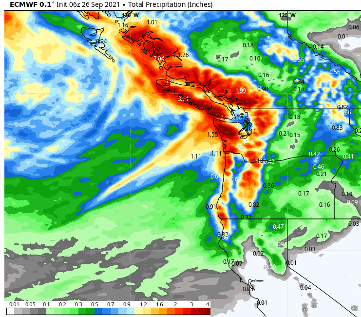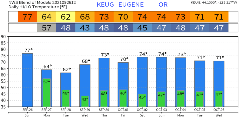
A medium strength storm system is on track to bring rain and showers to the area tonight through Tuesday afternoon. Rain will develop tonight sometime between 9:00pm and 2:00am, then switch over to periods of showers and isolated thunderstorms from mid to late morning Monday to about sunset on Tuesday. Total combined rainfall looks to be around 1/2"-1". This is not a windy system so winds will mostly stay around 10-15 mph or less, although we can see a few gusts to 20 mph as the front moves through tonight. Naturally, stronger winds are possible around any thunderstorm as well as some hail and a heavy downpour. Snow levels start out above 7000' but lower to 5500-6000' Monday night. Only expect an inch or two at the highest peaks. High temperatures will cool from the mid 70's-near 80 today to the low-mid 60's Monday, and upper 50's-low 60's on Tuesday. We'll then warm up a little on Wednesday. Regarding lows, Tuesday night will probably be the coldest of the week, bottoming out in the mid/upper 30's if skies are clear and winds go calm.
Wednesday will be dry, then the tail end of a system may clip our area on Thursday and allow for some light showers. However, I have to say that Thursday may end up being dry with just some clouds. Thereafter (and preliminary), it looks dry to around Oct 8-9 or so.
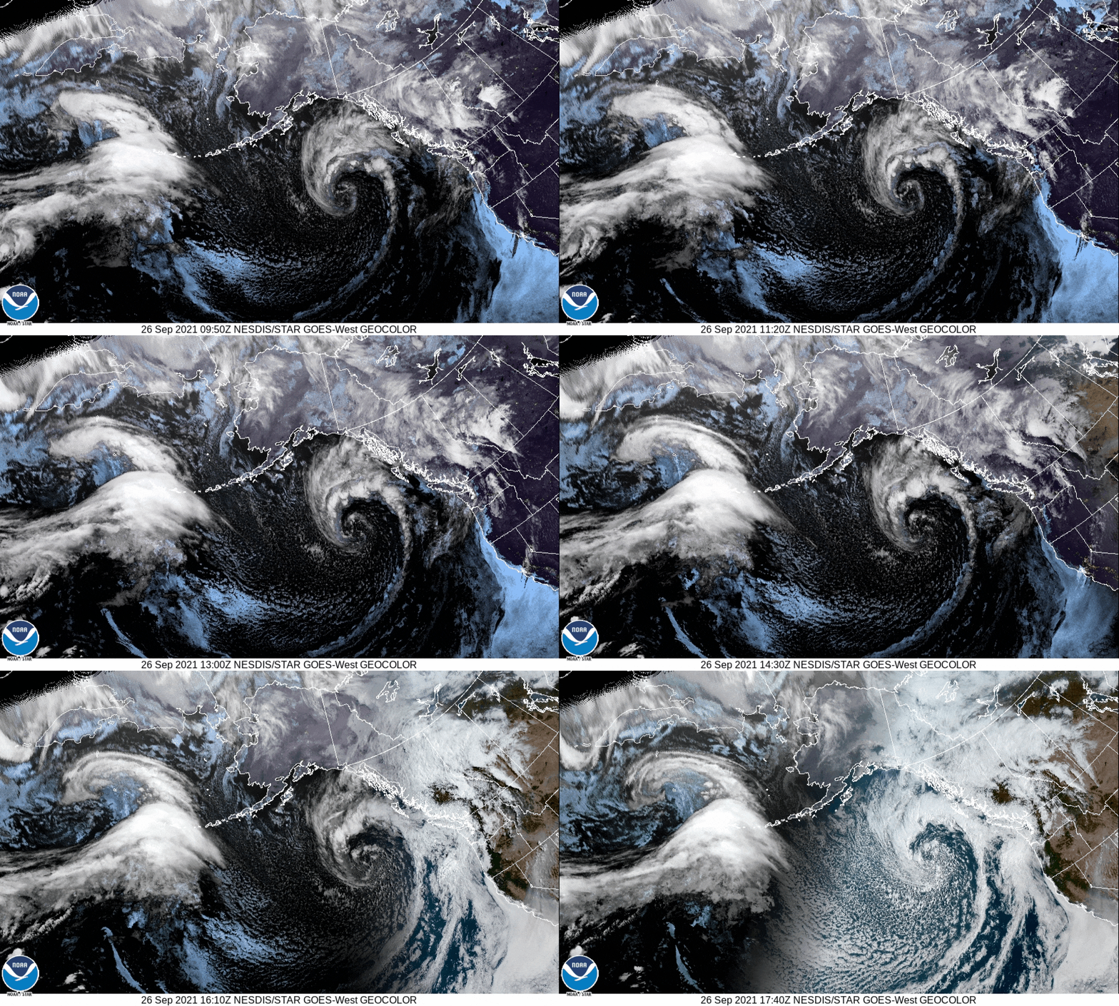
Check out the images below: 1) The satellite imagery shows a nice "comma," which is the main low pressure system that will bring our next round of precipitation. That shadow moving from right to left is the sunrise and the satellite switching over to "visible" mode from the nighttime "infrared" mode. 2) One of the more accurate high resolution models predicts 2/3" of rain for our area. 3) Blended modeled temperature predictions gives you an idea of what it looks like over the next 10-days (not set in stone). Fall is definitely here!


