In June 2021, I published a study (Special Report) addressing temperature and precipitation trends across Oregon and the West Coast states. Scroll through the images below for a better understanding of the trends and to put things into perspective. Note that La Nina has had a moderate to major impact on our fall / winter / spring weather over the past two years and is again expected to again affect our weather through Winter or Spring (a rare consecutive third year). Also note that there's no one single factor (overall) causing the drier periods, but rather a collection of events that may occur at various times during the year. Scrolling through the below images will give you some good insight of temperature and precipitation changes. Keep in mind that above normal temperatures during spring do not necessarily correlate to a hot and dry summer for Oregon, nor do above normal summer temperatures correlate to a warmer winter.
Main highlights of what we're seeing in Oregon (and the west):

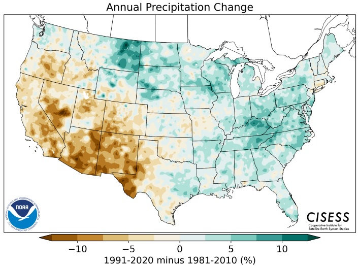
Annual U.S. Precipitation Change between the 30-year climate period of 1981-2010 and 1991-2020:
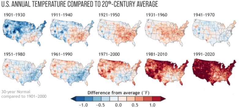
Below image shows the temperature trends of each 30-year climatological period since 1901:
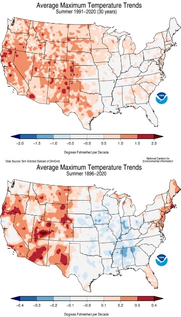
Below images are the "high temperature" trends during *summer* over the past 30-years (top) and since 1896 (bottom):
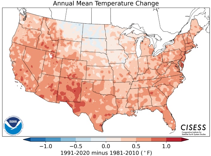
Below is the annual mean temperature change between the two 30-year periods of 1991-2020 and 1981-2010 (adding up all the highs + lows and dividing it by the total number of days):
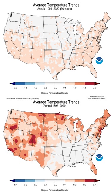
Two below stacked images are the most recent 30-year overall temperature trends (top image) and the overall trend of 1895-2020 (bottom image):
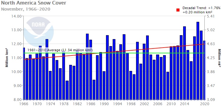
North America Snow Cover (below) trends towards a slight increase:
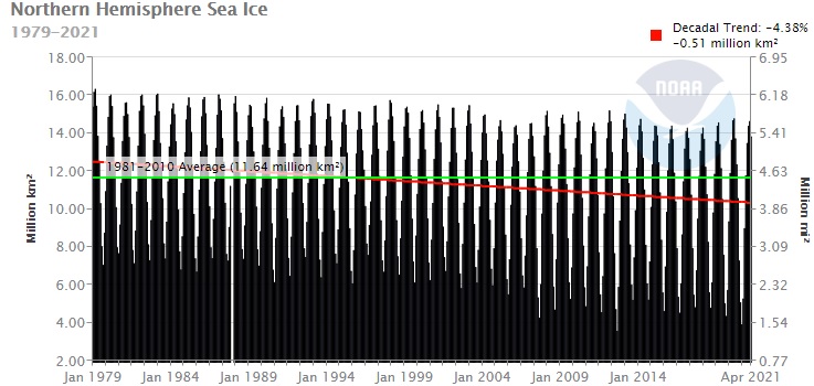
Below chart shows that Sea Ice (Arctic) is gradually decreasing (monitoring started in 1979):
Oregon DEQ report of Wildfire Smoke Trends and Air Quality:
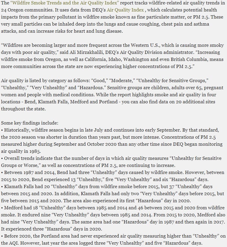
Click here for a more detailed report from the Oregon DEQ on the Wildfire Smoke Trends and Air Quality Index.