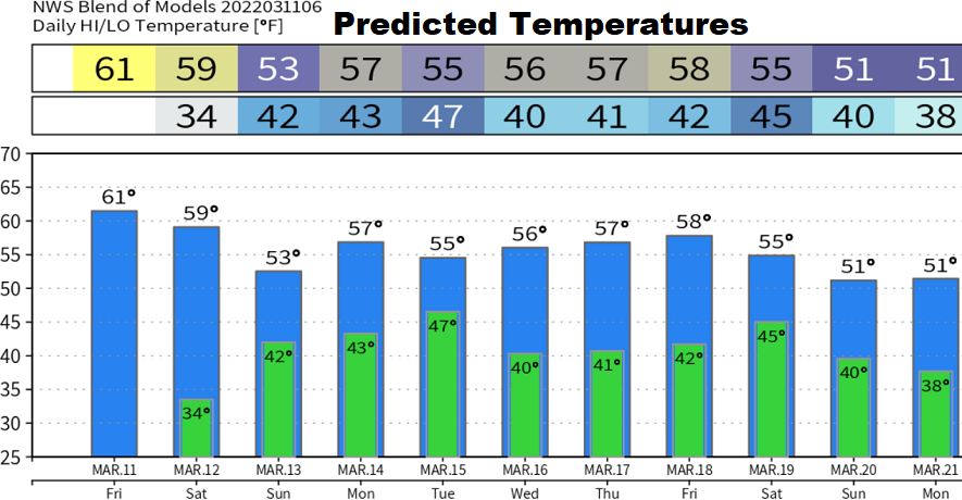
Friday March 11: Two storm systems will bring periods of rain to the area Saturday afternoon through Tuesday. Windy on Saturday. Total combined rainfall 1.00-1.50".
System #1, Saturday-Sunday: rain develops 1:00-4:00pm Saturday afternoon. Winds can gust up to about 25 mph at times, mainly noon to 7:00pm Saturday. Expect about 1/2" of rainfall through Sunday. Snow levels above 4000'.
System #2, Monday-Tuesday: rain develops late Monday morning or early afternoon. Winds can gust up to 20 mph. Up to 1.00" of rain possible. Snow levels above 6000' Monday then 5000' Tuesday.
Dry Wednesday-Thursday, then another set of storms may affect the region next Friday into the following weekend. These look like cold systems with low snow levels.
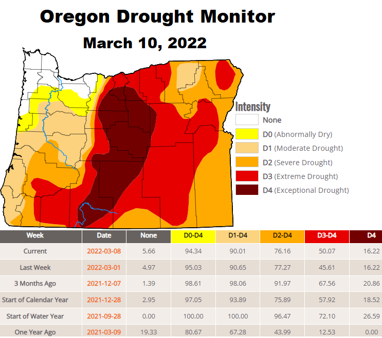
As of March 11, we've recorded 26.32" of precipitation. Normal to date is 31.52". Our region of the snow pack is at 85% of average, but the statewide average is only at 66%. Drought is worsening across the state due to our anomalously dry January & February. Check out the updated data and comparison.