Wednesday March 23: The Spring Equinox occurred this past Sunday (Meteorological Spring began back on March 1). Could see some sprinkles or an isolated shower through this afternoon, otherwise it looks dry through Saturday morning. Rain is then expected to develop Sunday afternoon into Monday morning (around 1/4"). Thereafter, next rain chances look to be Tuesday night and Wednesday of next week (around 1/2"). Snow levels will be above 5000'.
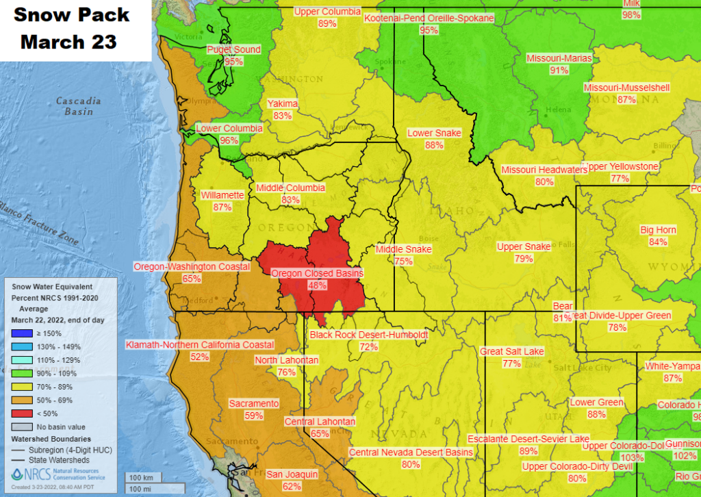
Since the start of the water year on October 1, we've recorded 28.07" of precipitation (normal is 33.81"). So far for March, we've had 3.64" of rainfall; normal for the month is 5.21". A whopping 89% of Oregon remains in drought. Normal high and low temperature is 59/36.
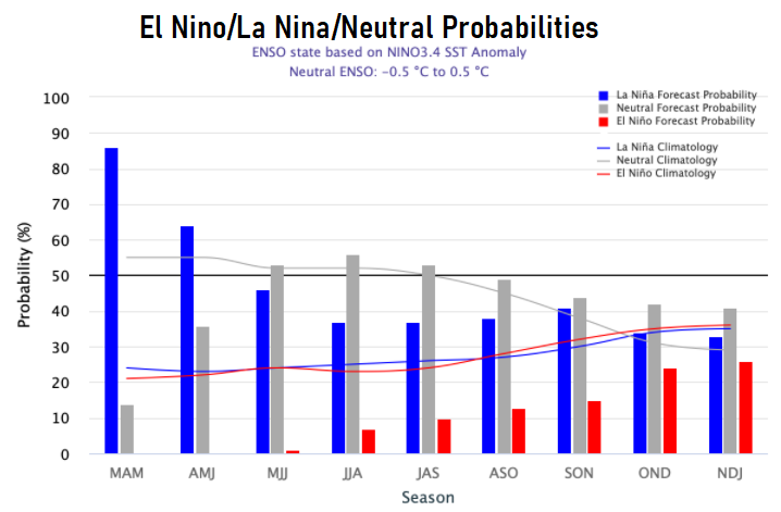
La Nina is now expected to dissipate during June or July. However, some data hints that a third La Nina may then form during fall. It is rare to have three consecutive La Nina's. As a reminder, La Nina and El Nino have three different strengths (weak, moderate, strong), each resulting in various impacts of anomalous precipitation and temperatures.
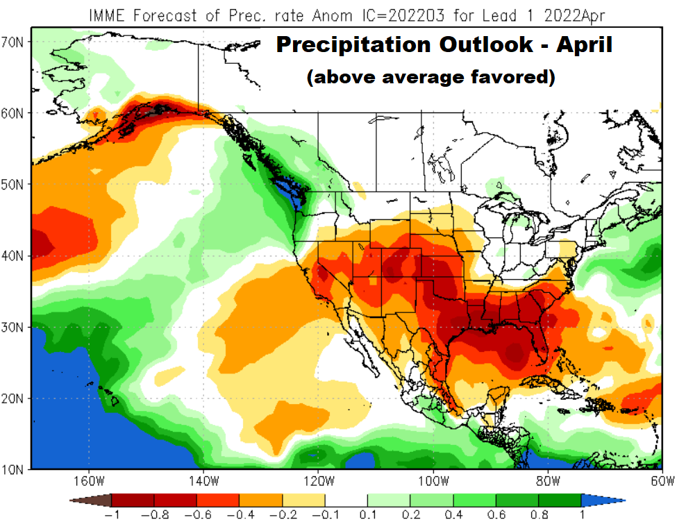
Odds favor above normal precipitation for April:
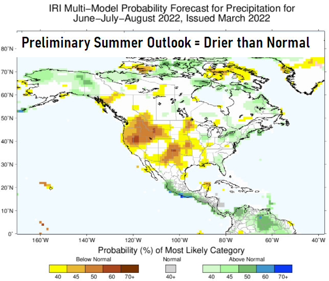
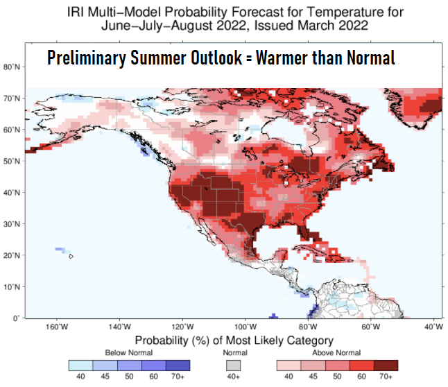
Preliminary summer outlooks favor above normal temperatures and below normal rainfall: