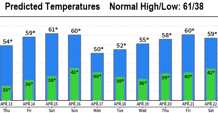
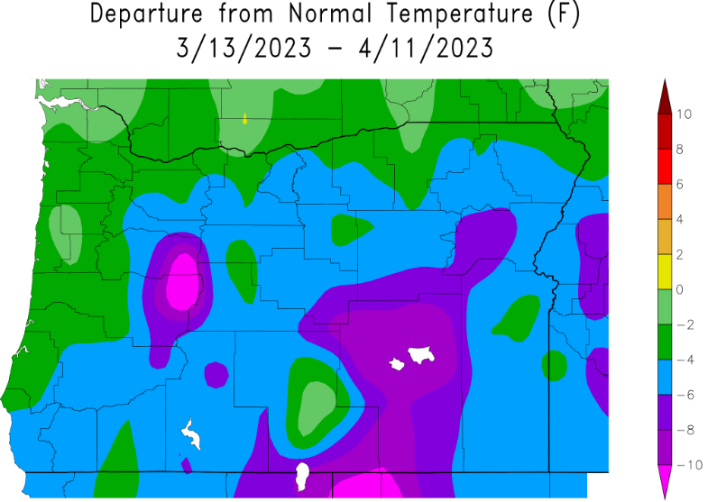
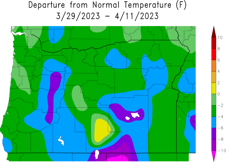
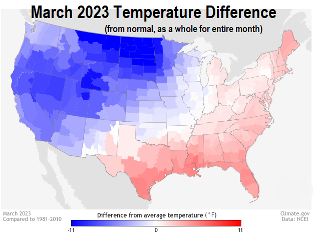
Just some light showers to sunset today with snow levels above 1500'. Dry Thursday through Saturday with a gradual warming trend (lows around freezing tonight and Thursday night). You're not wrong if spring so far has been much colder than normal (see maps/charts).
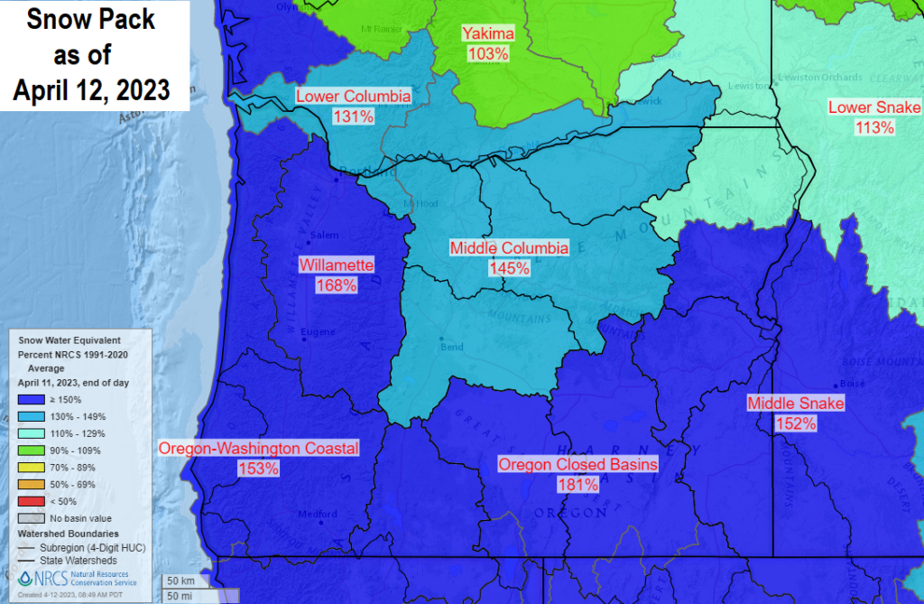
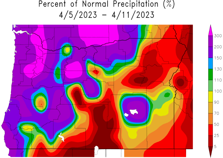
Good news is that these past few storms have dropped 1.58" of rain here in CG since Easter Sunday (as of 9am today). So now we're at 28.91" of precipitation since the start of the water year on Oct 1. Normal to date is 36.88, so we're behind by 7.97" (78% of normal). Check out the snow pack map below - it ranges at 145-181% of average across the state!
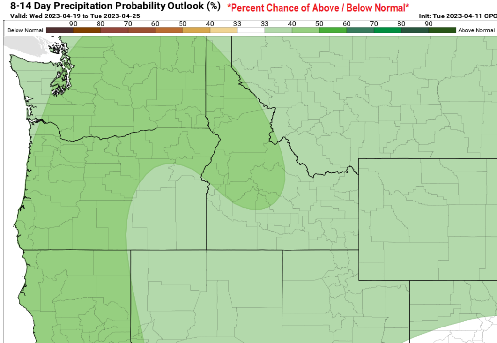
Another 3-4 storms are then expected to affect the region Sunday through the end of next week (won't rain all the time, will be a few breaks). We may see another 1-2" of rain out of these storms (preliminary). Early outlooks for May hint at near normal temps and below normal precip.