SNOW UNLIKELY THROUGH CHRISTMAS (BUT see next paragraph) It's going to turn colder here tomorrow and Thursday as Arctic Air pushes south. We'll be on the southern boundary of this very cold air mass so temperatures here won't be as cold as areas north of Eugene and east of the Cascades. For us, this will be an 18-hour event (Wednesday evening through Thursday morning). See temperatures below.
SNOW/FREEZING RAIN (HERE): There's a small chance of a dusting of snow or freezing rain here, particularly Wednesday night through mid afternoon on Thursday. Temperatures then gradually warm Thursday evening through Christmas Day. In fact, we'll be a good 10-degrees above normal for BOTH highs and lows Christmas Eve through Dec 26, so zero chances of a white Christmas (sorry).
TRAVEL WEATHER: Not good late Wednesday night through Friday evening for areas north of Eugene and east of the Cascades (Klamath Falls to the north). Will likely encounter freezing rain and snow. Roadways may be dangerous due to ice. Friday night onward should be ok, except northeastern Oregon with some snow and icy roadways. I-5 pass at CA/OR border looks ok with really no hazards.
Six to seven storm systems will affect the region through Dec 28, bringing periods of rain (totaling up to 4") and up to 4+ feet of new mountain snow. Bulk of this occurs Dec 26-28.
Now through Christmas Eve morning: just light rain/showers then rain during the afternoon through early night on Christmas Eve. Christmas Day looks to have only a few light showers, then heavy rain is expected to develop on the morning of Monday Dec 26 and continue through Dec 28.
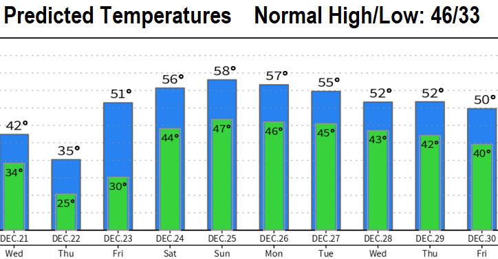
To give you an idea on how cold it will be, check out the lows Wednesday night and highs Thursday:
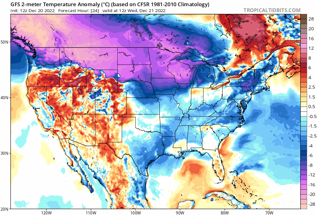
This GIF image shows the temperature ANOMALY to Dec 28. All that purple/magenta is Arctic Air. Look how we warm out west with above normal temps!