Doesn't look like things will align just right for snow here in the Grove today (Sunday) but north of about Salem has a good chance. Snow levels here 2000-3000' today. Shower chances will remain in the picture until about 8pm-ish. Light winds.
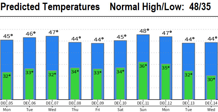
Looking dry Monday through Wednesday, then what looks to be four low pressure systems are expected to drop 2-3" of rain Thursday through Tuesday of next week. Snow levels with these storms will vary at 1500-3000'. Will have to keep an eye on how low the snow levels get Friday afternoon/evening and possibly early the following week (some data hints at 1000'). No wind concerns this week. Overnight low temperatures Tue-Thurs may end up a little cooler (28-31) than predicted below, especially if there's less clouds at night.
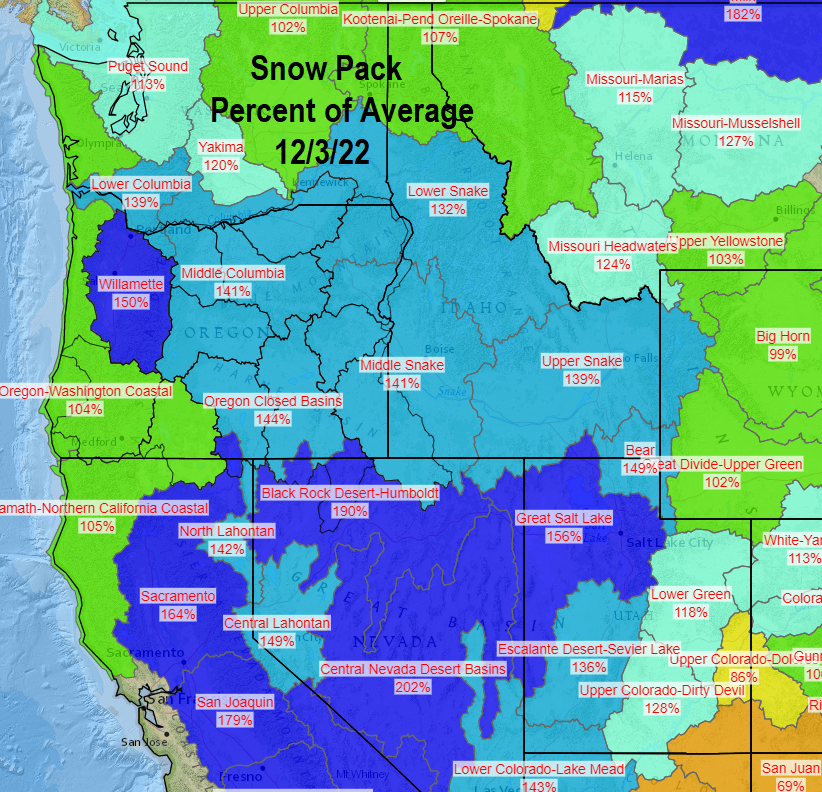
As of 10:00am Sun Dec 4, we've recorded 8.45" of rain since the start of the water year on Oct 1. Normal to date is 11.68" (72% of normal). On the other hand, the snow pack is way over 100% of average across the state and much of the west. This same time last year we were hurting with the snow pack at only 9-35%. Check out the map below.