Mon Dec 13 11:00am: Snow down to near 500-800' will be possible at times through tomorrow morning and again Tuesday night into mid-morning Wednesday. This is NOT looking like a snowmageddon, instead more like a dusting to an inch or two. Although best chances for snow in Cottage Grove is tonight into Tuesday morning and Tuesday night into Wednesday morning, some of the more heavier showers or colder columns of air can drop snow levels during the day down to near 800'. Roads may be icy, especially overpasses/bridges, tonight through tomorrow morning and early Wednesday morning. Lowland snow chances may return next week, but let's get through the next 48-hours then see what might be in store for us next week. Remember to keep your animals warm: lows are expected to be 28-32, high temps ~39-42. Winds will be light through tomorrow at mainly less than 10 mph with maybe a southerly gust or two to 15 mph.
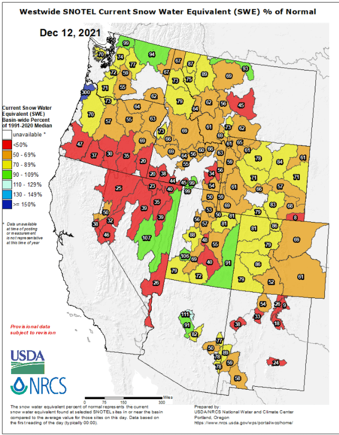
Here's how the snowpack Snow-Water-Equivalent (SWE) sits as of Sun Dec 12. Watch these numbers jump over the next few days - will post comparisons on Wednesday.