Similar to, but not exactly, the same setup as last week with a low pressure system sort of stalled off the coast. The current system is in a slightly different position that gives us a bit better chances to see more snow than last week.
WHY ALL THE DIFFERENT WEATHER? The low pressure system is generally hovering around offshore, spinning bits of moisture/energy into the region. This is resulting in mainly "scattered" precipitation (and peeks of sun during the day). We saw this yesterday where we had snow showers at times and just showers with no snow at times. This sort of pattern will continue through Tuesday afternoon or evening.
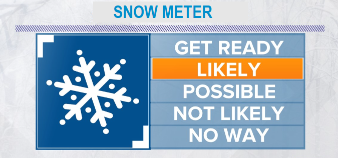
BEST CHANCES of accumulating snow is later this evening through Tuesday morning (a dusting to 5") and possibly Tuesday evening (a dusting). During the day today and Tuesday, a rain/snow mix to a dusting is possible at times.
TOTAL SNOW ranges from a dusting to 5". This is because precipitation will be "scattered" and it's anyone's guess as to exactly where snow showers will be more persistent to allow for accumulating snow. Chances that we'll see more than 5" of snow in Cottage Grove are extremely, extremely low.
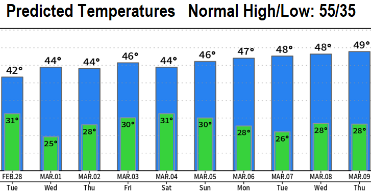
Continued cold over the next 10-days with much below normal temperatures (see chart below).
Next snow chances may be early Thursday morning, Friday morning, Friday night. Looks like a rain/snow mix to a dusting, but lots of uncertainties right now. At this time doesn't look like more than an inch.
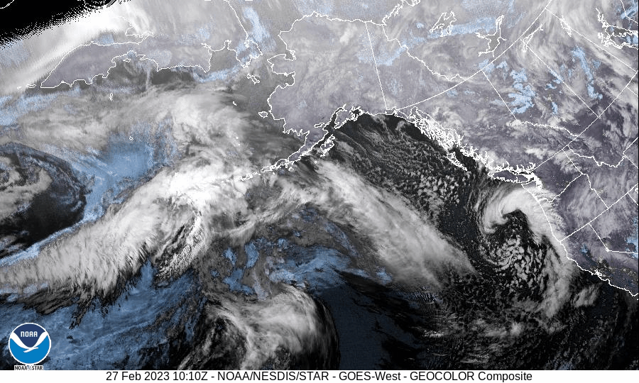
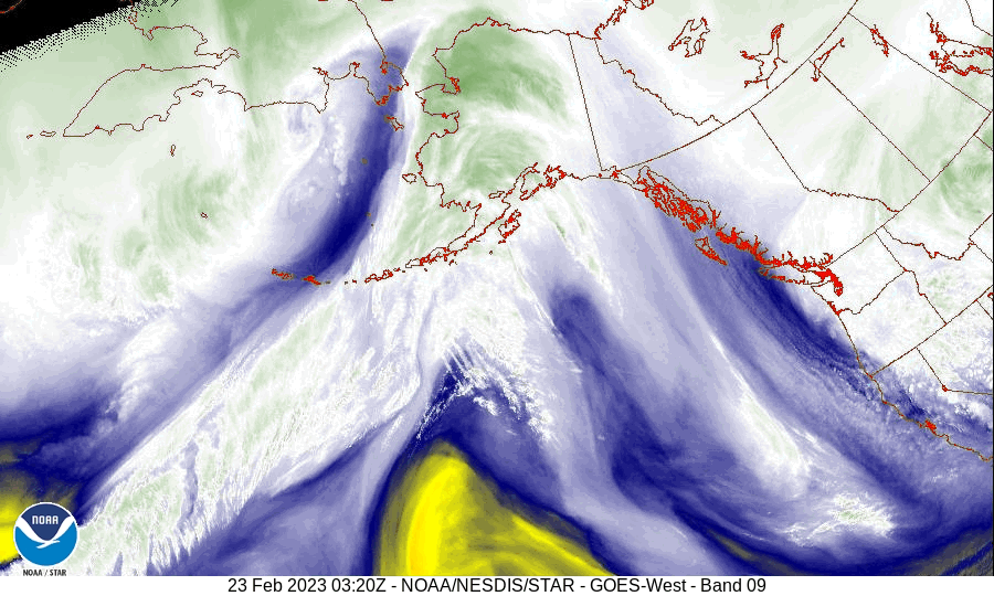
See for yourself: In the two satellite images below, look for the counter-clockwise rotation of the low pressure centers just off the Oregon coast around the WA/OR border. The image that is more crisp and clear is the current low pressure system. The one that's smeary white is last week's system. Note that both systems are "generally" in the same area. In the crisp image, look at the white spreckles. Those are "scattered" clouds, representing "scattered" precipitation.
Subscribe to receive updates when we post weather and preparedness updates to our blog. You can elect immediate, daily, or weekly emails. We anticipate a fairly low volume - 3 to 5 posts per week.