SNOW: Dusting to 1-4" likely through Wednesday morning...
February 4, 2025
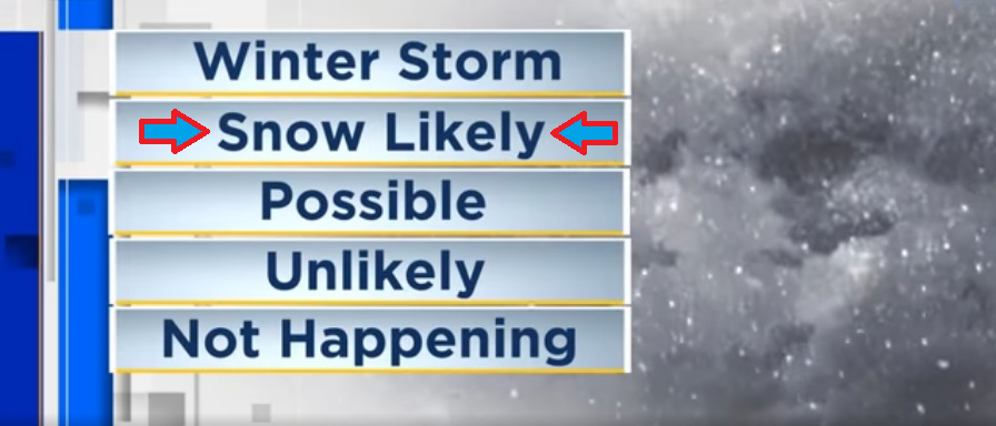
Tue Feb 4, 3:00pm: Snowmageddon, Ice Storm, Strong Winds HIGHLY UNLIKELY.LIGHT snow amounts likely (not 100% but close) this evening (Tuesday) through Wednesday morning - a dusting to 1-4" is possible (best odds are for a dusting to 2").
Snow possibilities of flakes to a dusting to 1-3" will then continue to be possible at times Wednesday through Saturday morning. Total combined snow from tonight through Sat A.M. may approach 2-6". Keep in mind that afternoon temps will be warm enough to melt most or all snowfall from the overnight / morning (if any snow falls / sticks).
Snow chances end at noon Saturday then we may be dry for a few days from Saturday night through Tuesday of next week (Feb 11).
There's some signs that several storms may bring us a lot of rain (no snow here) starting around Wed Feb 12. Still lots of questions and will update as soon as things become clearer.
Subscribe to receive updates when we post weather and preparedness updates to our blog. You can elect immediate, daily, or weekly emails. We anticipate a fairly low volume - 3 to 5 posts per week.