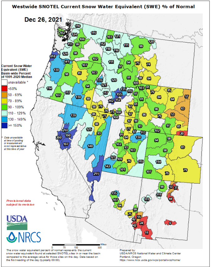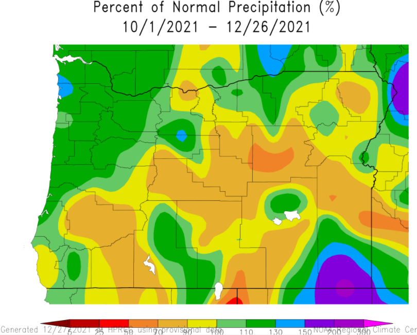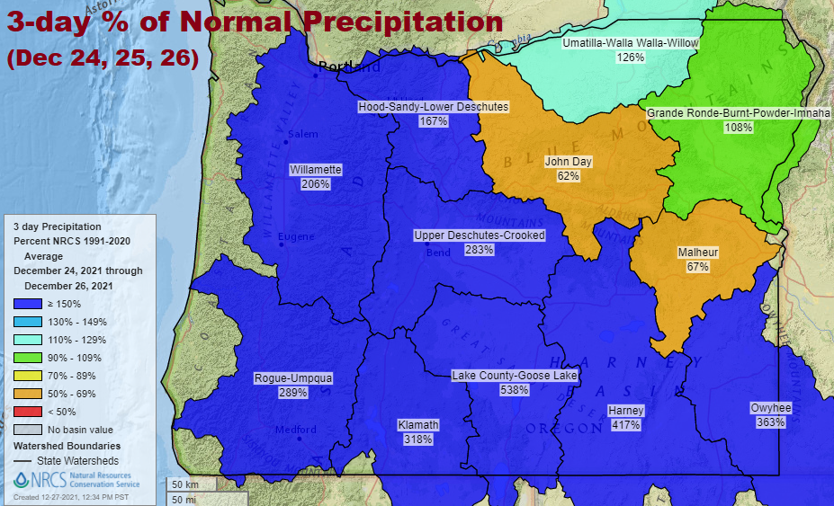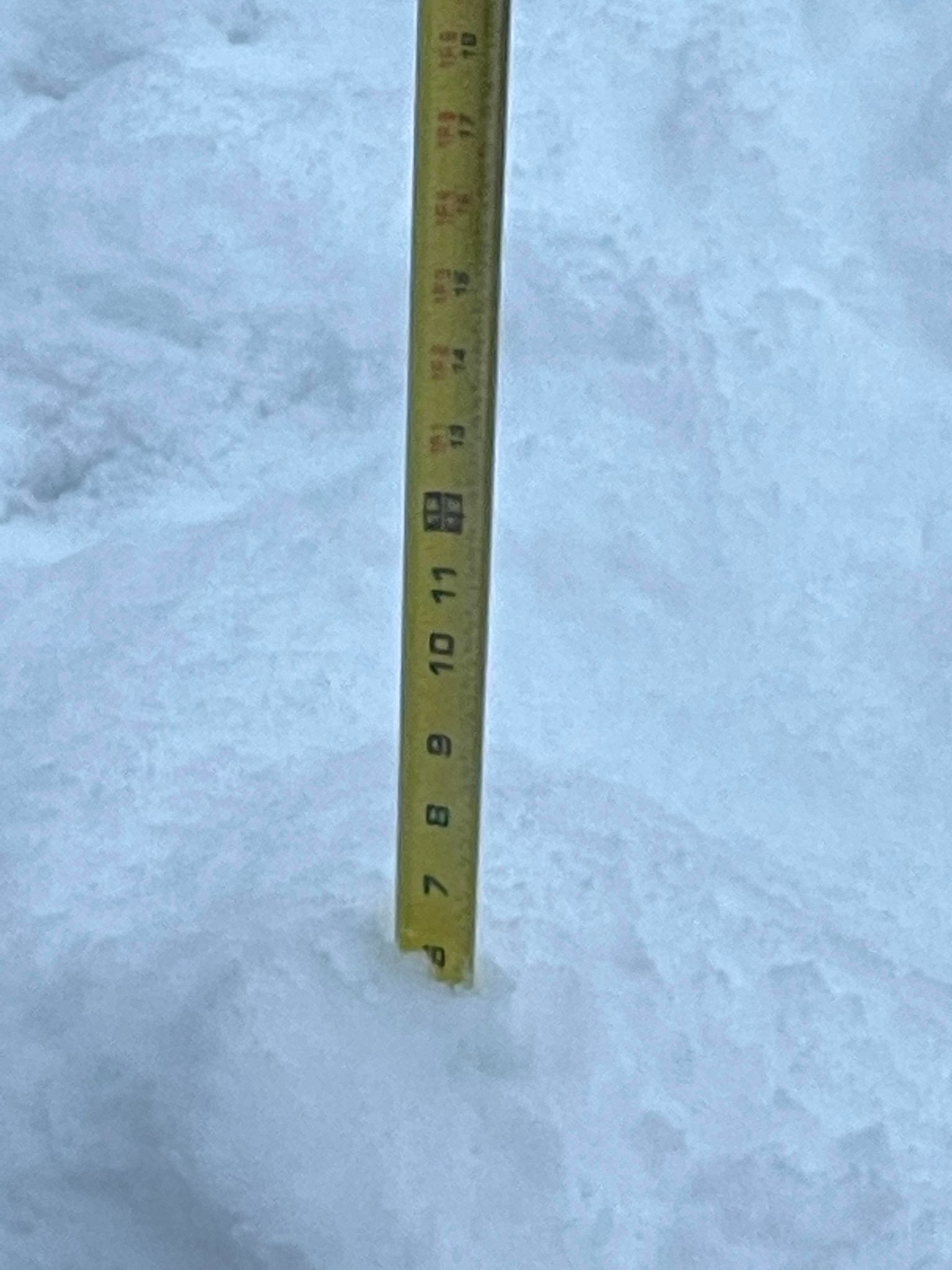
Monday Dec 27, 2021: Cottage Grove saw 5-7" of total snow between 10:00pm Christmas night to 7:00am this morning. The Cascades measured snow in feet, and this gave a much needed boost to the western snowpack. Periods of light snow can be expected this evening through tomorrow (Tuesday Dec 28), but is expected to total less than 1-3". A few light snow showers are possible on Wednesday (less than 1"), then the next storm system will bring light snow on Thursday morning which will changeover to a rain/snow mix for the rest of the day (Thursday).
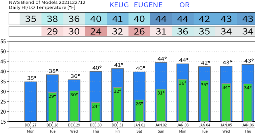
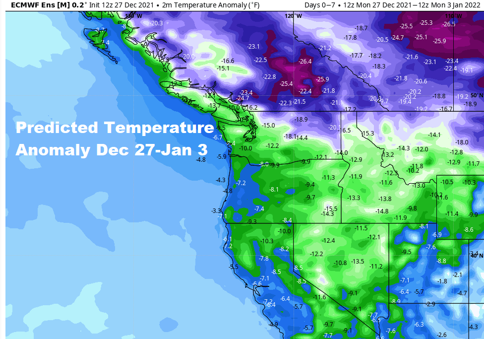
Normal high and low temperatures are 46/33. At this time, Thursday night, New Year's Eve, and New Year's Day looks mainly dry but continued cold. Ice will therefore continue to be a concern as we ring in the new year.
Thereafter, the next low pressure system should arrive Sunday afternoon or early evening. At this time, I'm generally not expecting snow below 1200'. Therefore, mainly rain is likely Sunday afternoon through next Wednesday Jan 5. However, since this will be a cold storm, I can't rule out a rain/snow mix at times on Tuesday morning and Wednesday morning (Jan 4-5). Total modeled rainfall Sunday afternoon Jan 2 through Wednesday Jan 5 looks to be 2-3".
Computer model data hints that a warmer storm may affect the region on Thurs Jan 6 with temperatures gradually warming. Based on the location and path of this projected system, there's the potential for another 1-2" of rainfall (Thurs Jan 6-Sat Jan 8). Snow levels will probably be above 3000-4000' during this time.