Showers now expected on Easter (but temps closer to normal)!
April 4, 2023
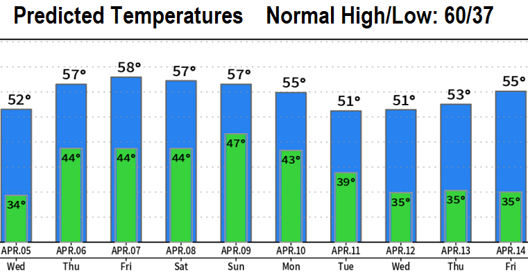
Three back-to-back storm systems will affect the entire region through Easter Sunday. Least wettest day looks to be Friday. No snow in Cottage Grove/Creswell/Drain/Eugene. Less than 1" of total combined rainfall through Monday.
Today (Tuesday)-Wednesday: Scattered showers, then light rain develops Wednesday sometime between late morning and early afternoon.
Thursday/Friday: Mainly light rain on Thursday, scattered light showers on Friday.
Saturday: Another storm arrives with light rain showers.
Easter Sunday/Monday: Light rain/showers.
Winds: Thursday and Saturday can gust up to 25 mph at times, otherwise breezes will stay below 15 mph.
️Snow: Snow levels above 2000' through Wednesday morning, then vary at 4500-6000' Wednesday afternoon through Saturday. Sunday/Monday above 6000'.
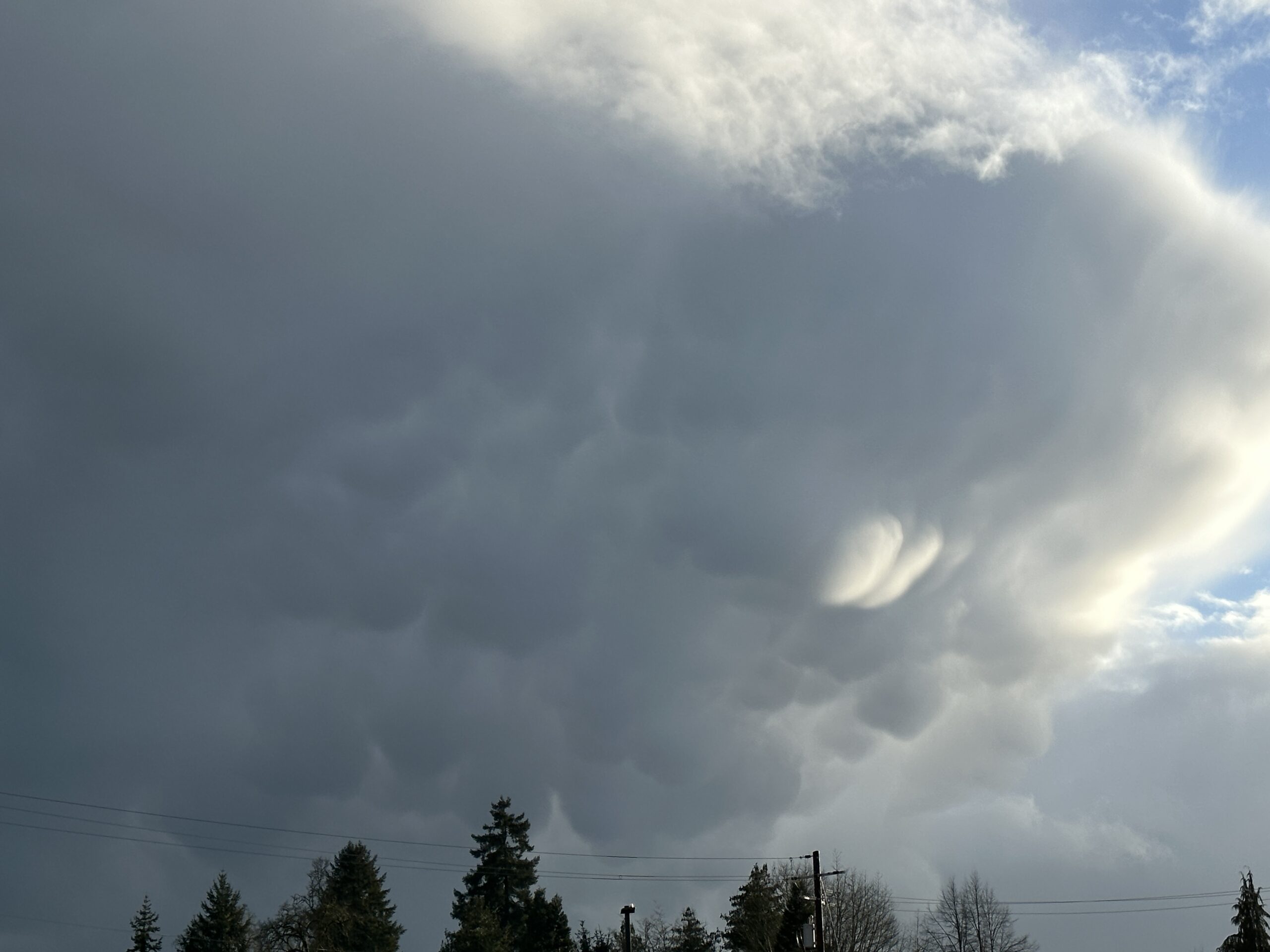
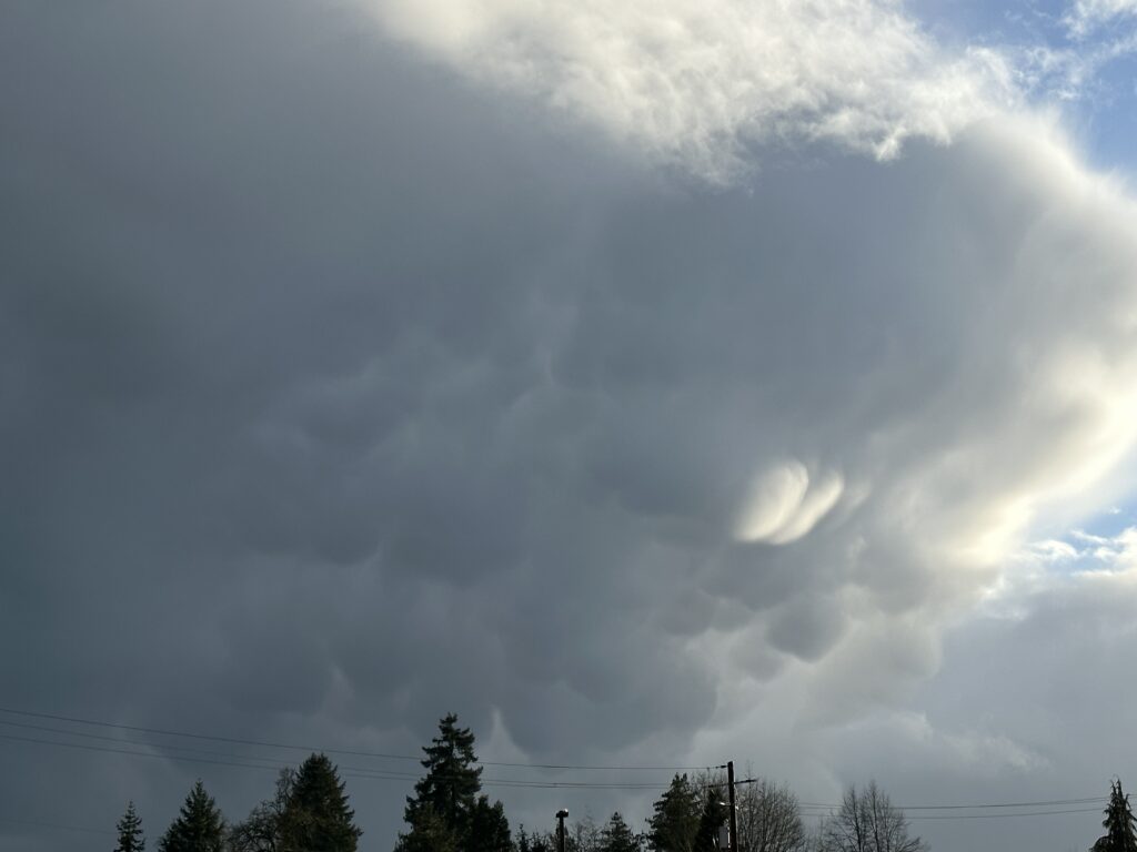
This picture was taken at 6:30pm Monday and is the underside of the anvil of a thundercloud. The "pouches" are Mammatus Clouds and form due to turbulence and sinking cold air. This is one of the thunderclouds that brought us small hail yesterday. I'm using the word thundercloud instead of thunderstorm because no lightning actually occurred (negative and positive charge separation within the cloud wasn't able to fully occur to allow for lightning - lighting occurs when the top portion of the cloud is filled with positive particle charges and the bottom is negative particle charges).
Subscribe to receive updates when we post weather and preparedness updates to our blog. You can elect immediate, daily, or weekly emails. We anticipate a fairly low volume - 3 to 5 posts per week.