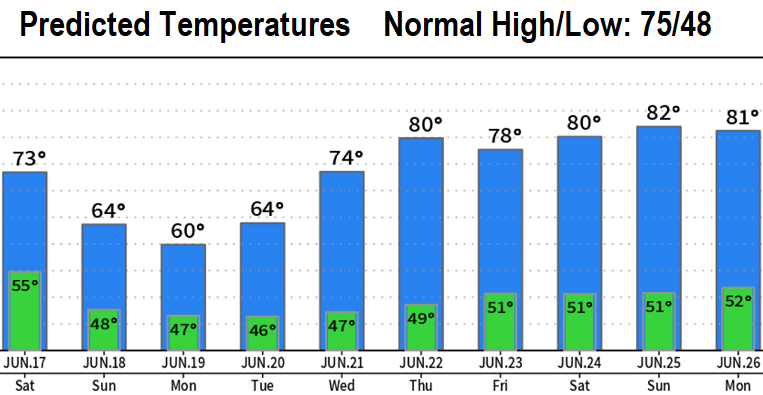
Cooler and unsettled weather ahead! Showers are in the picture Sunday through Tuesday, then high pressure builds into the region later next week for a return of summer-like temperatures (but not too hot). Looking farther out to the very end of June and into the first week of July, I don't see any excessively hot temperatures at this time - looks like high pressure will be prevented from becoming overly strong. A good thing.
Total Rainfall Sun-Tue: Looking like less than 1/4" of total rainfall; Monday will likely be the wettest (and coolest) day. The good news with this is that it helps with the fire danger.
The Summer Solstice occurs on Wednesday (June 21) at 7:57am local time. It's the longest day of the year.
