What: Enjoy our break right now between storms, as a series of four medium to strong strength low pressure systems are set to affect the region Thursday afternoon or evening through Tuesday. Periods of rain, breezy-windy conditions at times, and snow above 5000-6000'. It will also be noticeably cooler Saturday into next week.
Timing: Storm systems will pass through about every 24-36 hours, beginning Thursday afternoon.
Hazards: At this time, wind gusts are expected to remain under 30 mph through Friday. Some uncertainty exists with the systems Sat-Mon, when we could see wind gusts to 35 or 40 mph (will update this potential on Friday). Clogged storm drains from fallen leaves may result in some spotted and minor street flooding.
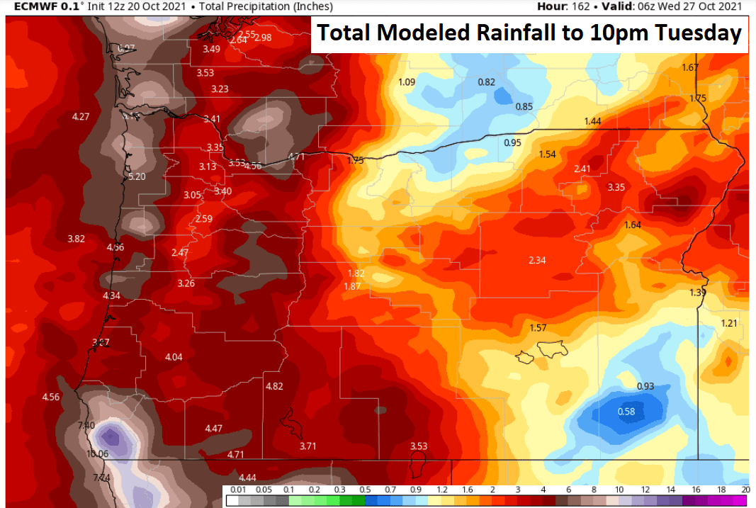
Total Rainfall: Combined precipitation Thursday evening through Monday is expected to be around 1-2". The rain may be heavy at times, especially on Sunday and Tuesday. Total average rainfall for the month of October is 3.67". As of 5:00pm today (Wed Oct 20), we've recorded 1.29 so far for the month. It's looking like we'll close out the month with at least near normal rainfall.
Wind: No strong wind concerns through Friday. Gusts will mostly stay between 15-25 mph as each storm front passes through (particularly Thursday afternoon and Friday afternoon). Saturday morning could also be breezy. Sunday may be windy, but I want to see how data trends over the next couple of days before raising the flag for 40 mph winds.
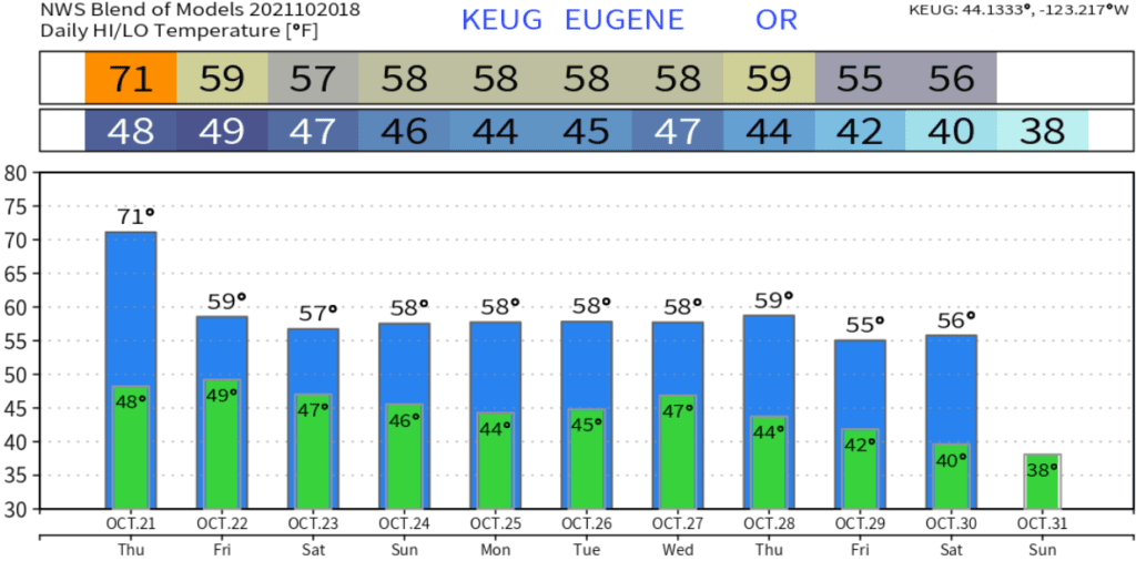
Temperatures (5-days): Highs in the mid 60's to near 70 on Thursday, then 50's Fri-Sun. Lows in the 40's through Saturday, then upper 30's to low 40's Sunday night through much of next week. Normal high/low is near 62/40.
Fog: Low chances tonight-Thursday morning and again Friday night-Saturday morning.
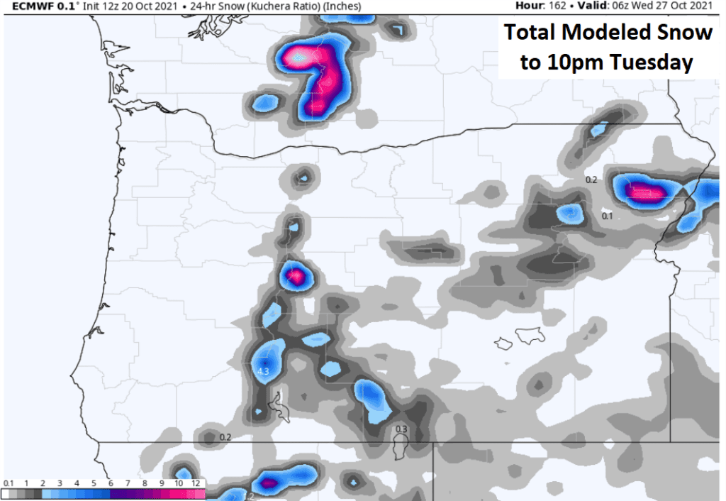
Snow Potential below 1000': Not going to happen.
Frost/Ice probability: Widespread frost is not expected over the next 7-10 days.
15-day Outlook: Looking wet through Oct 28 or 29, then possibly dry Oct 29 or 30 and 31 (low accuracy). Nov 1-4 may have a couple of systems pass through, then high pressure may block storms for several days beginning around Nov 5. High temps look to be near to slightly below normal with lows close to normal.
Seasonal Outlook (90-days, preliminary): Slightly better chances for above average precipitation, good chances for near normal temperatures (as a whole, within +/- 5°F).
Model Projected Total Rainfall to 10:00pm Tuesday:
Modeled Total Snow to 10:00pm Tuesday:
Temperatures look like this over the next 10-days: