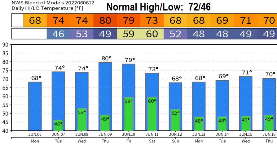
Monday June 6: Our weekend storm was able to squeeze out 0.72" of rain, putting us at 39.45" of precip since the start of the water year on Oct 1 (as of 8am). We're now at 94% of normal. Our region of the snow pack is 147% of average. Scattered showers will linger through this morning, then the afternoon should be mainly dry with only a small chance of an isolated shower.
Tomorrow (Tuesday) could see a few isolated showers between 6pm and midnight, otherwise dry. Wednesday will be dry and probably Thursday too (just a small chance of a shower late Thursday afternoon into the evening).
Friday into the weekend, the weather pattern becomes messy again. At this time, it looks like light shower chances increase Friday evening with rain/showers Saturday morning into the afternoon. A light shower or two may linger into Sunday. That's how it looks right now. It appears that Saturday morning will be the wettest of the next 7-days. Expect some changes with the weekend forecast as better data comes in.
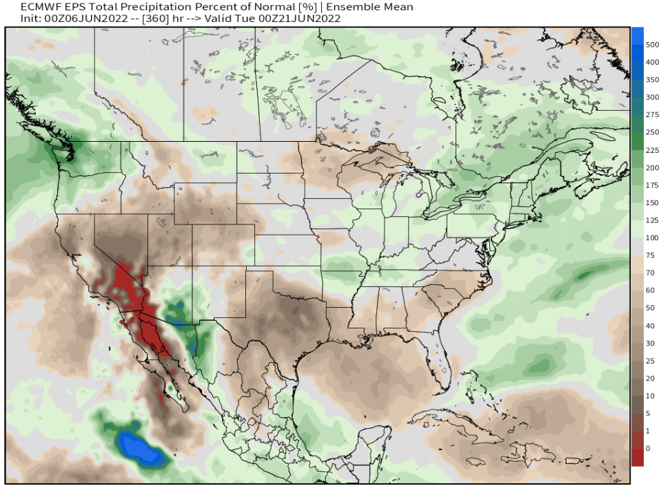
The below map is one of the more reliable model's outlook through June 20. As you can see, it favors above normal precip across the PacNW for the period. Keep in mind that our total normal rainfall for June is 1.57". Signals for July hint at above normal temps and below normal rainfall.