Two low pressure systems, breezy at times, 1.75-3.00" of rain through Tuesday morning or afternoon. Isolated thunderstorms with small hail.
WINDS: It'll get breezy at times with wind gusts of 15-25 mph through Sunday. Monday's system will be the stronger of the two so wind gusts of 25-35 mph will be possible.
SNOW: Above 6000'+ through Monday morning then above 4000'.
COLD: Nope through Sat Mar 1! Normal high/low 55/36. Temps way above normal (especially lows) through Monday, near normal Tuesday, then gradually warm again starting Wednesday.
Tuesday evening onward: Looks dry through Friday, light rain chances possible on Sat March 1, then maybe dry for 2-3 days starting Sun Mar 2. A cooler period possible March 2-9 but temps will probably only be slightly below normal and not excessively cold. Nothing extreme expected.
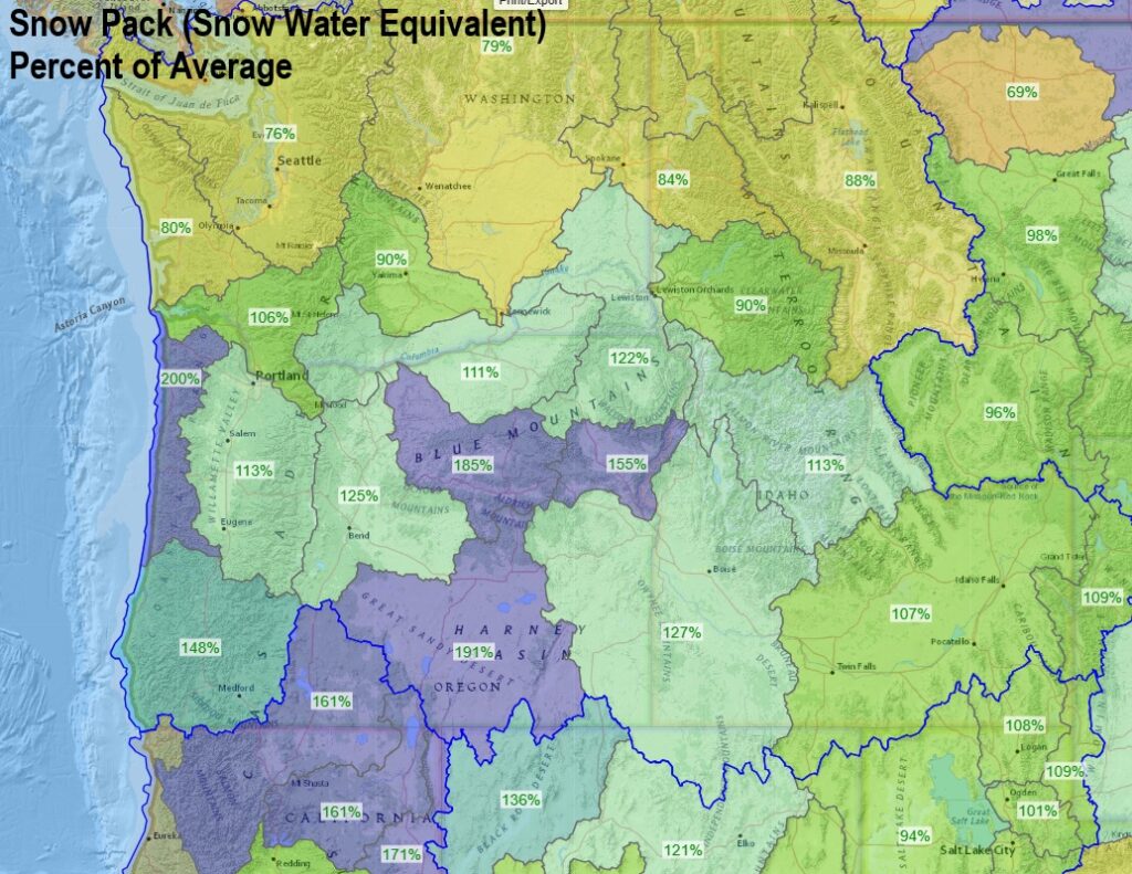
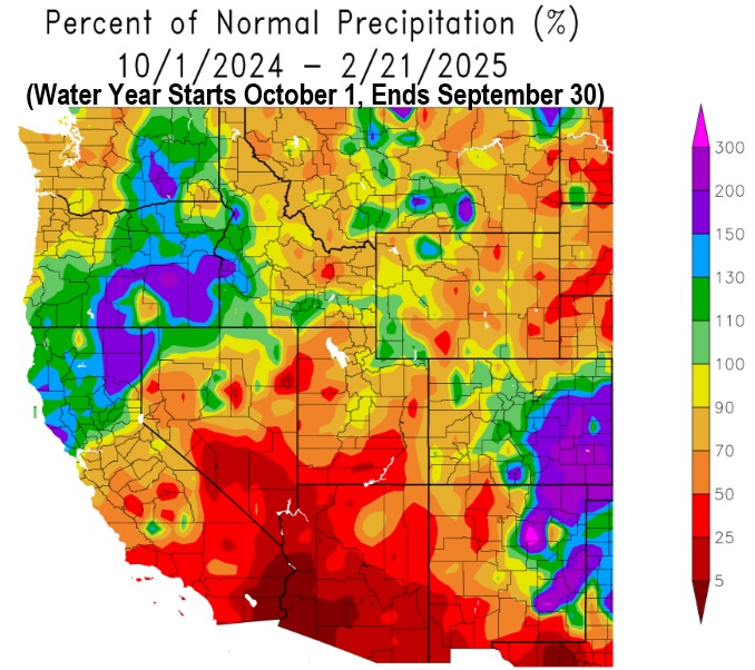
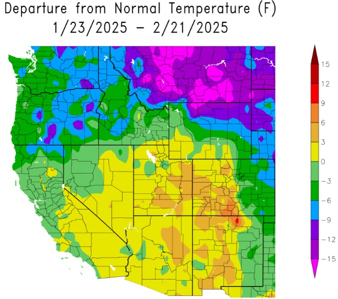
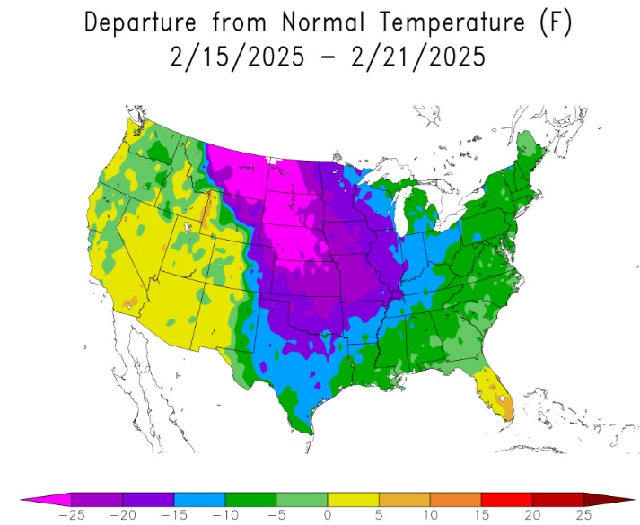
MAPS: Check out the maps below - departure from normal precipitation + temperatures and the snow pack! Aren't you glad we're not in the middle of the country?
Subscribe to receive updates when we post weather and preparedness updates to our blog. You can elect immediate, daily, or weekly emails. We anticipate a fairly low volume - 3 to 5 posts per week.