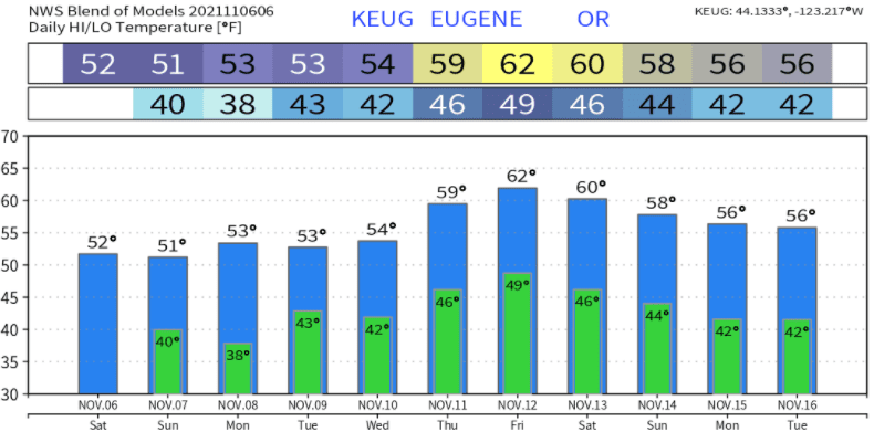
More or less, typical Oregon weather of periods of rain/showers through Wednesday (nothing to write home about). Total rainfall through Wednesday looks to be around 1/2"-3/4". Nothing concerning with southerly winds, which can gust up to 15 or 20 mph at times. Thursday through early next weekend, a couple storm systems could bring an additional 1-2" of rain to the area. However, there's some uncertainties with these late week-next weekend systems which should be cleared up for the next post on Monday. Also starting to see some signs that the middle of the month might be more dry than not due to strong high pressure possibly dropping anchor across the west coast. Temperatures look like this over the next 10-days (normal is 56/39):
Rain/Snow/Drought
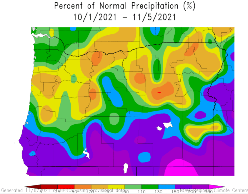
As of 9:00am this morning (Sat Nov 6), 6.21" of rain has fallen since the start of the water year on October 1st. Normal to date is 4.90", so we're off to a good start. By comparison, at this same time last year we were only sitting at 2.39" of rain. Here's the water year to date precipitation percent of normal:
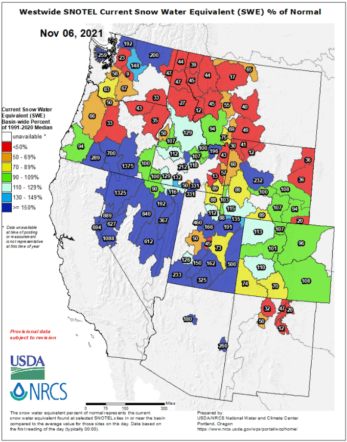
Regarding snow, it's still early in the season, but here's where we currently stand:

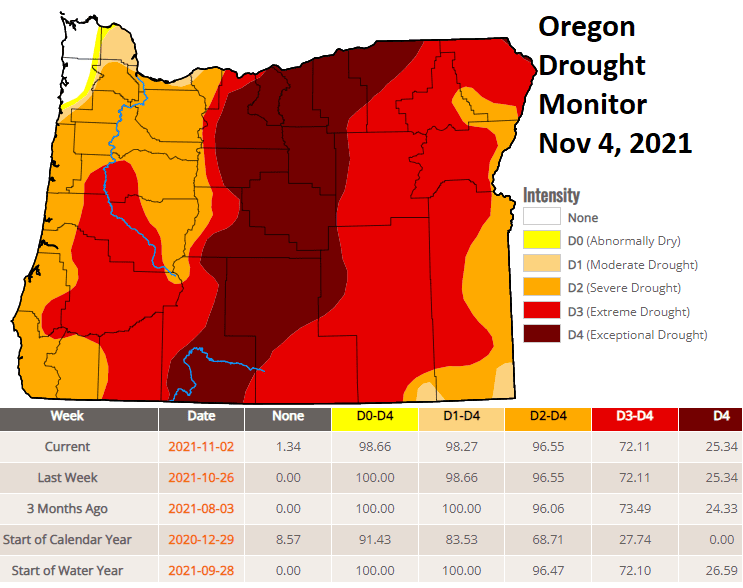
Our drought was so intense that all the rain we've had so far this fall hasn't yet made any sizable improvement:
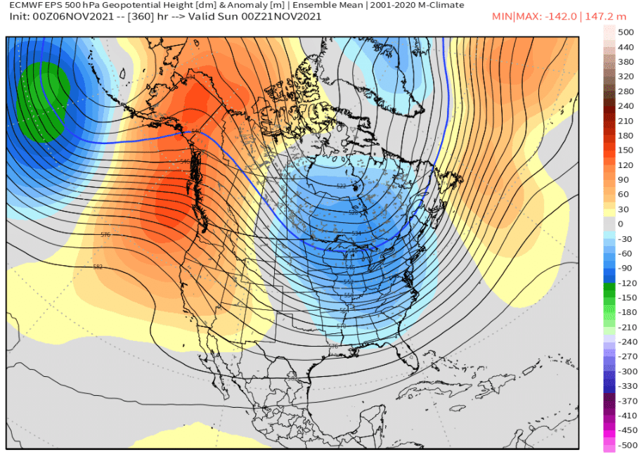
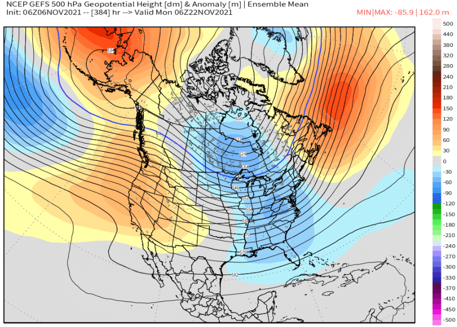
Dry middle of November + Thanksgiving?
Around November 14, high pressure may strongly build into parts of the North Pacific and west coast states, pushing the storm track into far northern Washington or southern Canada. Interestingly and preliminary, the majority of the models are showing good odds that high pressure may affect much of the west coast from about November 14th through possibly Thanksgiving (Nov 25). I'll continue to address this with updates issued between now and then since Thanksgiving is traditionally the busiest holiday-travel period. Here's the two major models, which show anomalous western high pressure (red/orange = anomalous high pressure; blue/green = anomalous low pressure):
