*UPDATED SATURDAY 11:00am* The "cut-off" low pressure system (cut-off from the jet stream) is trekking south offshore, as predicted, and will get stuck and hang around just offshore of northern California through Wednesday. Although unlikely, can't rule out sprinkles or a brief light shower through this evening before shower chances increase tonight.
Tonight-Sunday morning: A secondary "mini" low pressure system develops southwest of us. This will spin moisture and instability into our area, increasing shower chances. Best time for rainfall is 11pm tonight to about 8am Sunday (1/10" or less is expected). Can't rule out a rumble of thunder. No wind concerns. Increased humidity.
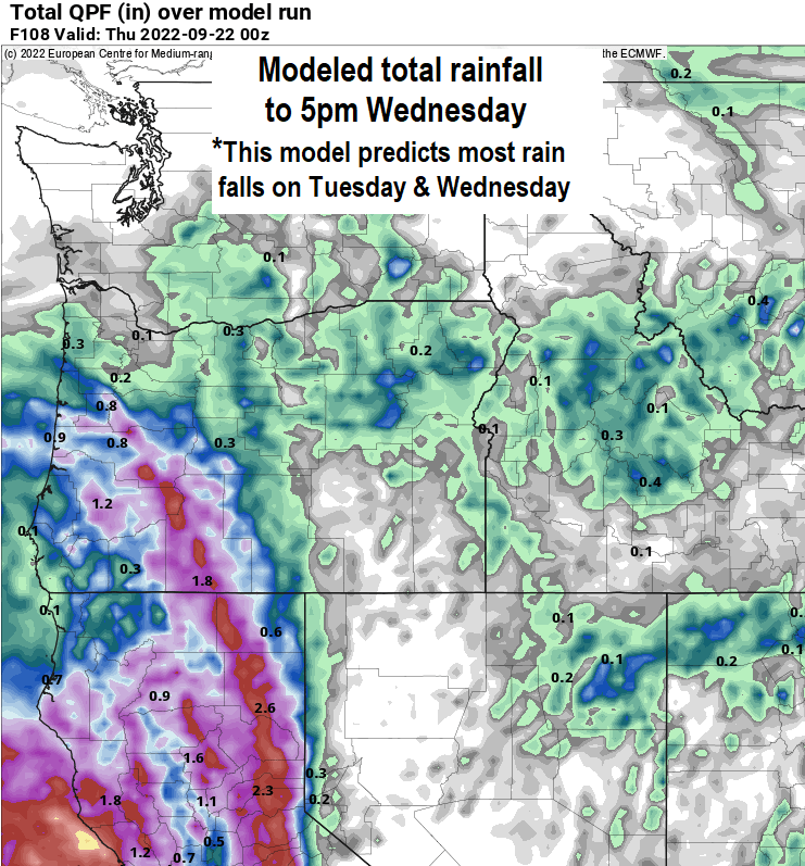
Monday-Wednesday: The center of this storm system will generally wobble around offshore of NorCal (several hundred miles west of San Francisco). Low pressure systems spin counter-clockwise, and will "spin" bands of rain into California.
For us, the system will spin additional moisture into our area Monday evening through Wednesday, causing light shower chances across our area. Total rainfall could be anywhere between 1/10" to 1/2" due to uncertainties of exactly where the bands of moisture will be. Temperatures will be tricky due to how much cloud cover we ultimately get.
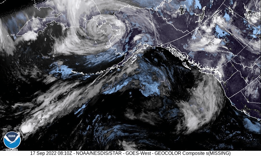
Check out the satellite image along the west coast. Look for the center of the low pressure system spinning offshore of the OR/CA border. By the way, that shadowed line moving across east to west is the sunrise.