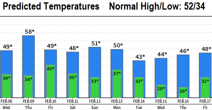
A very cold low pressure system is expected to affect the area Monday and Tuesday of next week (see predicted temperatures below). This system will pack enough cold air and moisture, that, if the winds cooperate and ingredients come together just right, snow levels could drop to near 500'. At this time, there is at least a low possibility of seeing snow later Monday into Tuesday morning (again, IF everything aligns just right). As a disclaimer, snow predictions are only accurate within 72 hrs and most especially within 24 hrs. Therefore, this possible snow event is still far enough into the future for things to change. I'll certainly be putting out updates about this in the coming days.
Until then, 1/4" or less of light rain/showers through this evening with mainly light breezes and no strong wind concerns. Dry Wednesday and most of Thursday, then another round of light showers Thursday night through Friday evening with isolated showers on Saturday until sunset. Dry Sunday, then the snow prediction challenge begins on Monday.