Thursday Weather Update: A weak storm system will drop 1/4" or less of rainfall Friday into early Saturday morning. This is a fast moving system, so rain / showers will develop 10am-2pm Friday and end by 10:00am Saturday (can't rule out a lingering shower into Sat afternoon). Snow levels mainly 3000-4000' Winds will be light.
Check out the predicted below normal temperatures (especially lows) over the next 10-days. Our normal high/low is 54/38. Brrr!
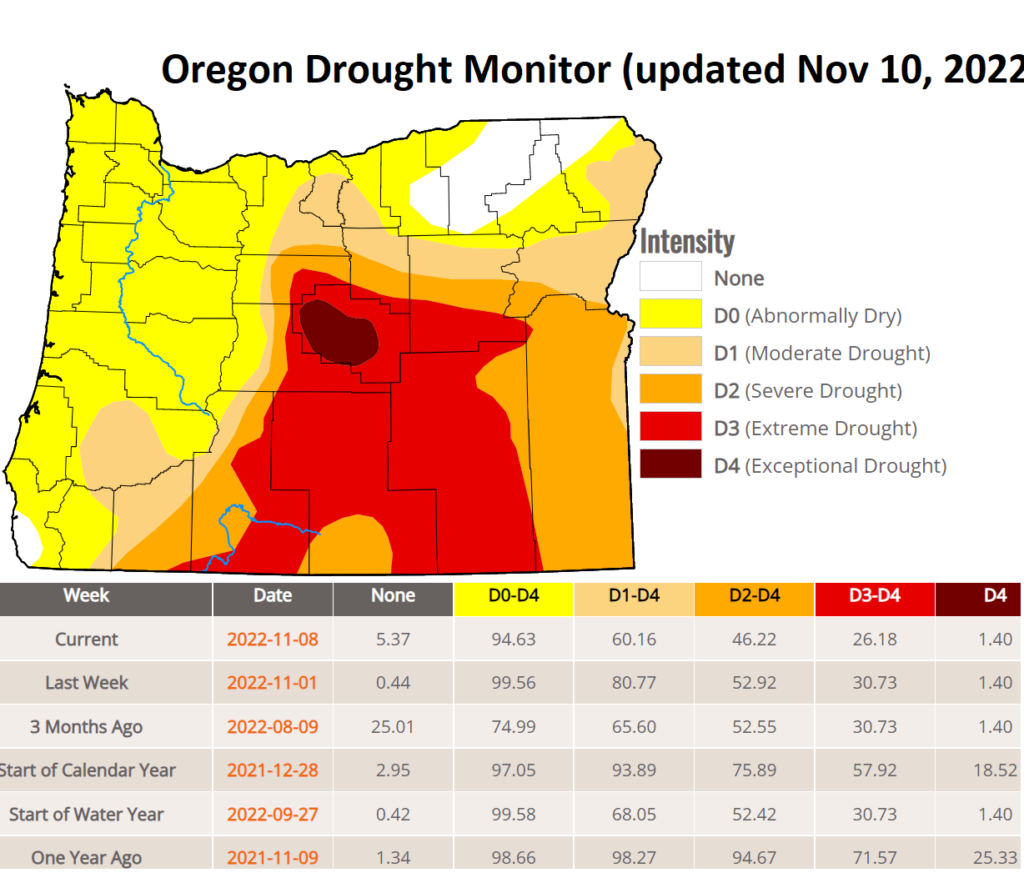
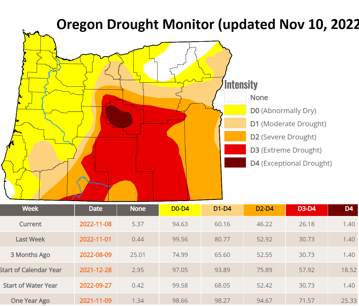
As expected with all the rain we had over the past 10-days, drought numbers have improved by 20%. However, we're still worse off now than we were in August due to our abnormally dry Sept + Oct.
Except for tomorrow's weak storm, the dry period looks to continue to about Nov 20. At that time, the strong and anomalous high pressure that's blocking storms is expected to break down with a resulting wet pattern through Thanksgiving (Nov 24) and probably into at least early December.