What: Breezy tonight, with some wind gusts to somewhere between 20-30 mph. Light rain will develop later this evening with showers on tap for Tuesday. Total rainfall will be around 1/5-1/3" (0.20-0.33"). Snow levels above 6000' tonight, lowering to near 4000' Tuesday. Another couple of storm systems will bring periods of rain and showers through Friday, then Saturday and Sunday look dry.
Timing: A break in the rain may occur Tuesday night, Wednesday morning through Friday evening looks rainy/showery.
Hazards: Nothing significant. Heavy rain is possible later Thursday and on Friday.
Total Rainfall: Looking like 1/5-1/3" through Tuesday evening, 1/4" on Wednesday, then 1-2" possible Thursday through Friday evening. Total average rainfall for the month of November is 6.92". As of 11:00a today (Mon Nov 8), we've recorded 1.92" so far for the month and 6.47" since the start of the water year on Oct 1.
Wind: Breezy later this evening into early Tuesday morning. Winds can gust up to between 20-30 mph, especially between midnight and 5:00am.
Temperatures (5-days): Highs low-mid 50's Tue/Wed, then upper 50's-low 60's Thur-Sun. Lows upper 30's to low 40's through Thursday morning, then mid 40's Thursday night through Sunday night. Normal high/low is near 55/39.
Fog: Possible in between systems, especially Tuesday night and Friday night through the weekend.
Snow Potential below 1000': Not going to happen.
Frost/Ice probability: Widespread frost, freezing temperatures, icy roads are not expected over the next 7-10 days.
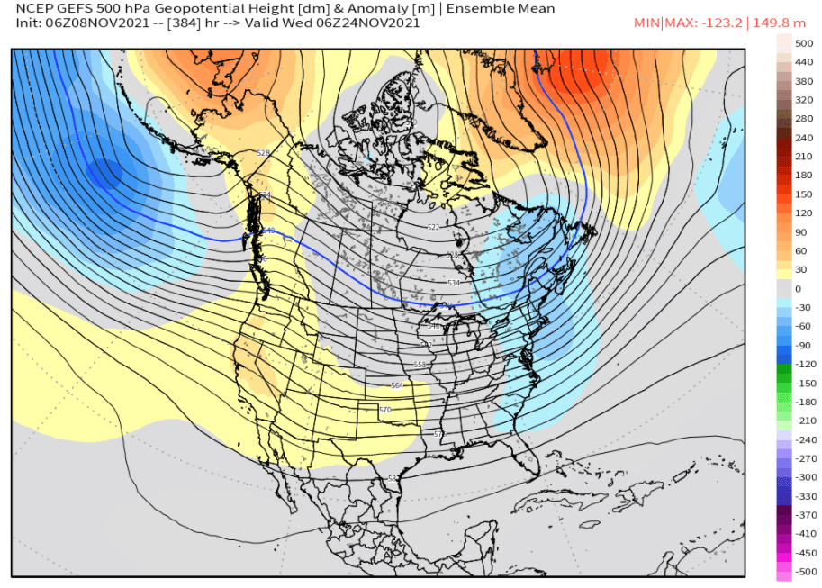
15-day Outlook: With the weekend looking dry right now, another storm will bring rain to the area on Monday (Nov 15). Things start to dry out later Tuesday of next week with hints that high pressure may become strong and therefore push the jet stream farther north. Although some uncertainty exists, it's possible that an extended dry period may occur from later Tuesday of next week (Nov 16) through around November 24. If high pressure becomes dominant across portions of the North Pacific and West Coast, our Thanksgiving might end up dry (low accuracy and preliminary). High temps look to be near to slightly above normal with lows close to normal.
Seasonal Outlook (90-days, preliminary): Slightly better chances for above average precipitation, good chances for slightly below normal temperatures for December-January-February (low accuracy and preliminary).
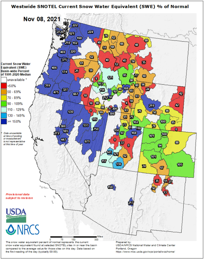
Current Snow Percent of Normal (Water Equivalent):
Most models indicate anomalous high pressure will become established across much of the west and parts of the North Pacific, including during all or part of Thanksgiving week. This model's ensembles shows just that (a bunch of "mini models" within a main model that predicts various outcomes - we look for an average or "mean" of these "mini models" to give us an idea of what may be to come in the longer range):