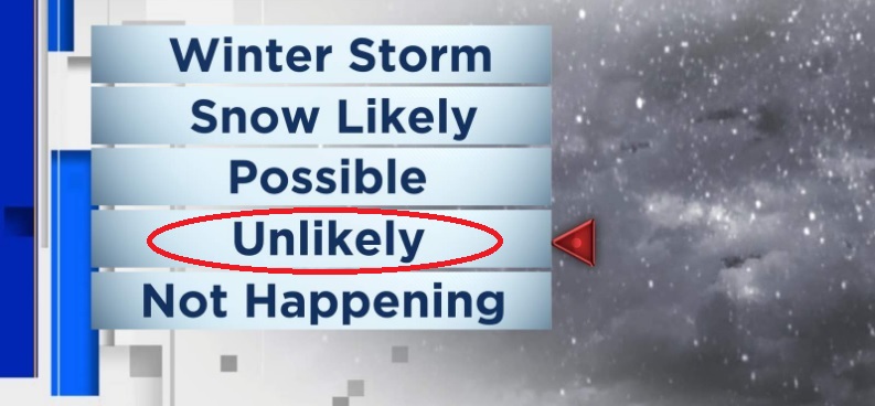
SNOW: No snowmageddon expected. Although very small chances of very light snow will exist here anytime between Thursday morning and Friday morning, the latest data shows lessor chances of snow levels dropping below 1000'. Not saying that we won't see a dusting, but chances are now smaller. Snow levels through Wednesday above 2000'. Thursday 1000-1500'. Friday 900' morning then 2000' (but by this time very little moisture will be left to cause snow so don't hold your breath). Saturday 2000'.
WIND: Could see some wind gusts to 30 or even 35 mph. Strongest winds look to occur between 9:00pm tonight and 8:00am Wednesday morning with the bullseye at midnight to 7am.
RAIN: Light rain/showers will be possible starting this evening. Heavier rain occurs between 1:00am and 10:00am, when up to an inch can fall during this period alone. Showers will then occur for the rest of Wednesday. Light rain / showers Wednesday night through Thursday afternoon. Total combined rainfall Wed + Thurs: 1-1.50". Looks like a break after 9am Friday with the next storm then moving in early Saturday morning, adding about another 1/4" of mainly light rain. Dry Sunday then another storm on Monday.
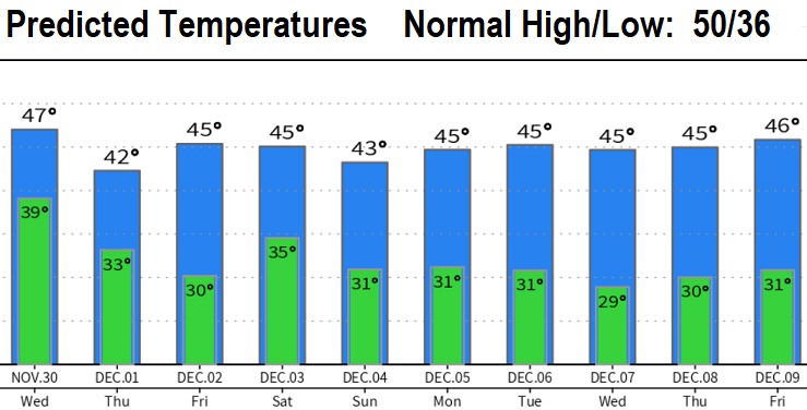
TEMPERATURES: Below normal temps are expected over the next 10-days. Near freezing to freezing lows expected starting Wednesday night, but Sunday night through next week lows have the potential to be in the mid to upper 20's at times. Roads may become icy nights and mornings.