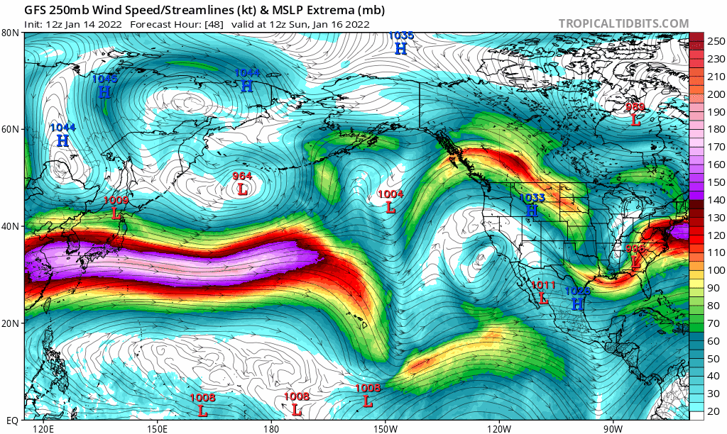
January is our 3rd wettest month, but it will be more dry than wet over the next 10-14 days. Anomalously strong high pressure across the west and over the North Pacific is causing the jet stream to buckle and keep storms north of our area. The video shows the jet stream at 35,000 feet (yellow/red/purple) bucking due to strong high pressure. Therefore, this stagnant pattern of light-calm winds and night/morning dense fog with varying amounts of clearing will continue into early next week. This doesn't mean we won't see any rain over the next couple of weeks, but rather any storm systems that do pass through will be weak with little precipitation. As of this writing, light showers are possible on Tuesday and Thursday of next week. Seeing signals that we might revert back to a wet pattern with slightly below normal temperatures towards the end of January and into February.
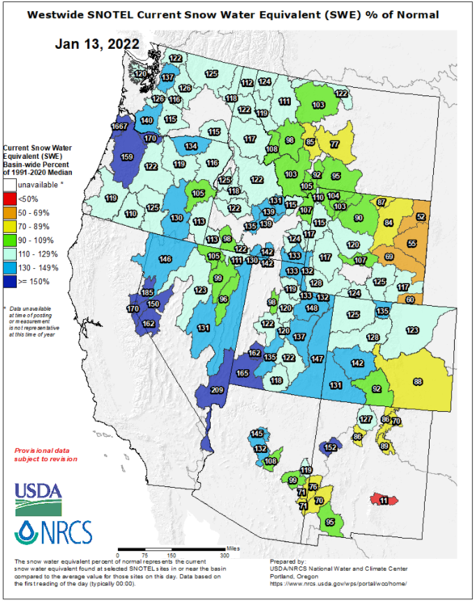
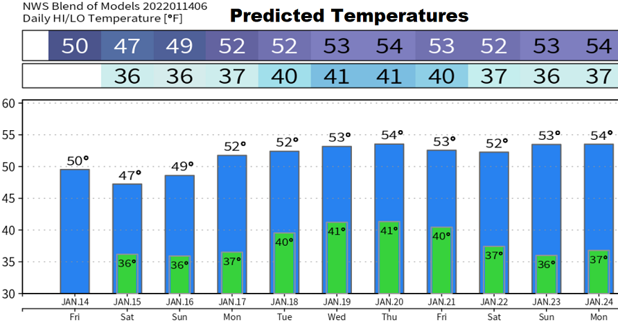
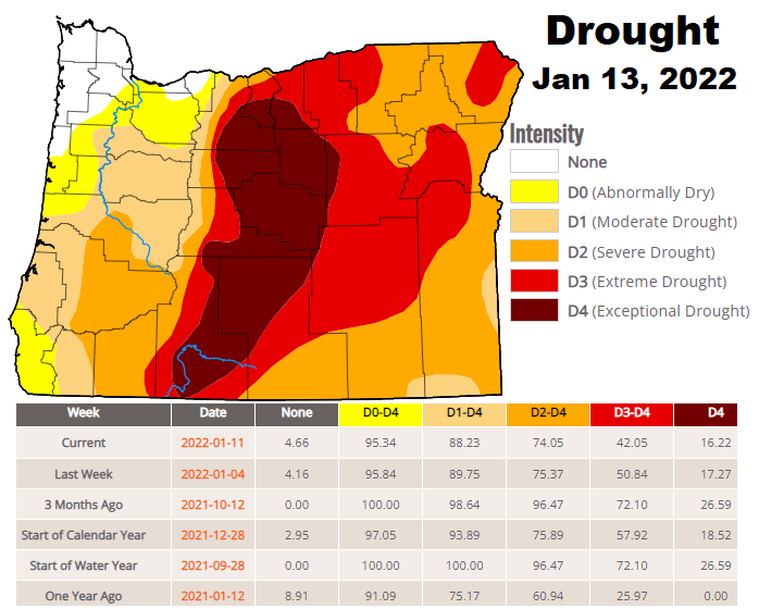
Our normal high/low is near 48/34. The water year begins on Oct 1. YTD precipitation is at 110% of normal and the snowpack is 159% of average. Drought continues to ever so slightly improve with each week's update.