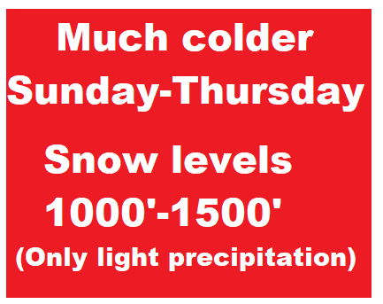
Thursday Feb 17: A big change in the weather pattern will occur Saturday night as a pair of cold low pressure systems affect the state through Tuesday. High temps will struggle to make it above 45 and lows may dip into the 20's as early as Monday night. In fact, Tuesday night may be in the low-mid 20's. A dusting of snow in Cottage Grove is possible later Monday and Tuesday morning, otherwise snow levels 1000-1500'. Total rainfall Sun-Tue looks to be under 1/3" since these systems don't have a lot of moisture. Winds can gust up to 20 mph at times Sun + Mon, and possibly to 25 mph on Tuesday.
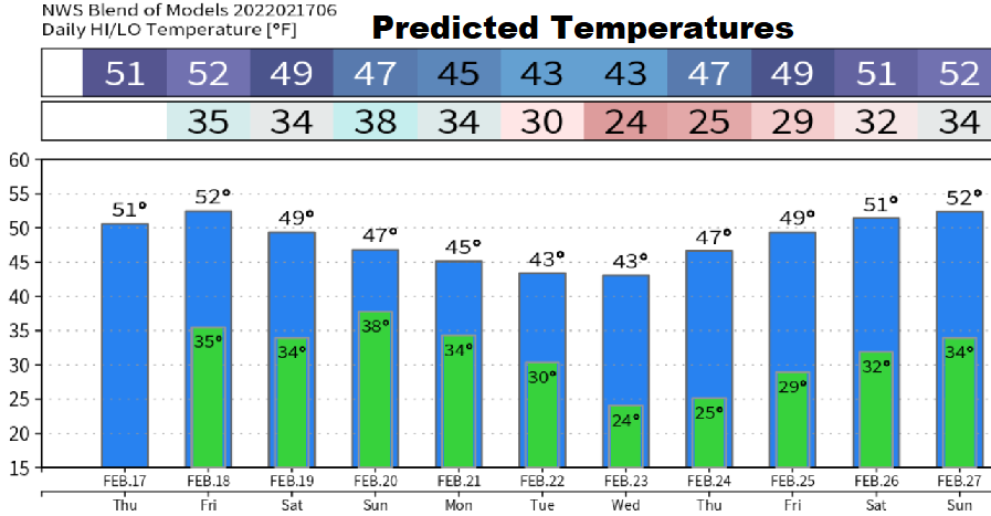
Dry weather returns later Tuesday through Thursday. Looks like a series of storms may then affect the state next Friday (Feb 25) through the following weekend (Feb 26-27).
Meteorological Spring begins on March 1. Clocks spring ahead on March 13. Astronomical Spring begins on March 20. Preliminary indications are that March may have slightly below normal temperatures and near normal precipitation.