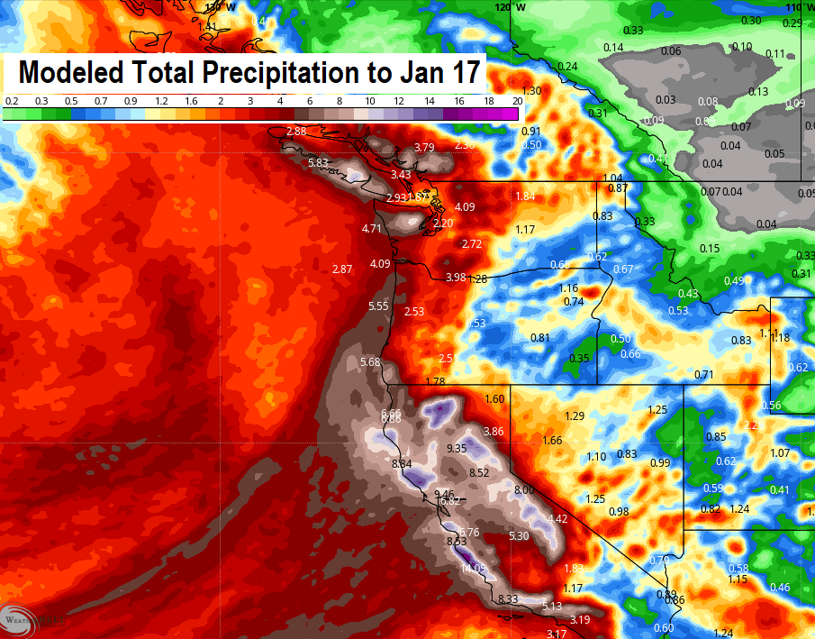
Although periods of rain and showers will occur through next weekend (Jan 15), the wettest parts of the storms will be aimed into California. Total rainfall for us through next weekend looks to be around 1.5-2". But parts of California can see a foot or more of rain (see rainfall map below), which means that over the next 7-days you'll be hearing a lot on the news about major / record flooding in California.
But up here, just typical Oregon weather with some wind gusts to about 25 mph at times as each storm passes through. Breeziest days look to be Sunday, Monday, and Thursday (gusts up to 25 mph or so). Snow levels through Tuesday 4000-5000', then 5000-6000' Wed-Fri. We'll likely see some night/morning fog in between systems. If all that rain would come in here instead of California, we'd certainly be very concerned about flooding possibilities here because these are warm systems and low level snow melt would aid to runoff. But, again, no flooding concerns at all here. I do wish we were getting a little more rain, as we're at 14.85" of precipitation since the start of the water year on October 1. Normal to date is 19.51", so we're running behind by a decent amount (currently at 76% of normal).