Mix of Sun / Rain, Temps Roller Coaster...

March 4, 2025

Just an isolated light shower through this afternoon (Tuesday), otherwise dry through Sunday. Next low pressure system begins affecting the area on Monday but there's some uncertainties as to whether the track will be aimed here or into Northern California. This will mean the difference of whether we stay dry on Monday with a storm system then moving through Tuesday-Thursday or if two back-to-back storm systems pass through Monday through Thursday of next week. More questions exist for Friday / Saturday of next week (March 14-15) which will mean the difference of whether it's dry or wet.

  • Right now, it looks like the storm door may stay open through at least around March 20, so basically expect a mix dry days with some sunshine and days with rain plus a few breezy periods of wind gusts to around 20 mph. Total projected rainfall to March 20 ranges at 1.50-2.50". Typical Spring weather (more/less).
  • Although below normal temperatures are expected overall through March 20, temps will likely roller coaster so expect some days to be at or even slightly above normal (mainly daytime highs).
  • TOTAL RAINFALL: Since the water year began on Oct 1 and to today (Tue Mar 4), rain gauges at two local weather stations are at 38.19-39.46". Normal to date is 30.49", so we're sitting at least at 125%.
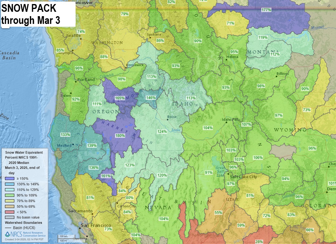
  • SNOW PACK: As of Tue March 4, statewide Snow Pack is 93-192% of average. Our region, the "Willamette Basin" is at 93%.
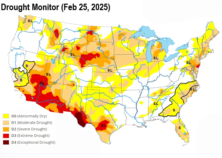
  • DROUGHT: No part of Oregon is in an official drought nor is drought expected anytime soon.
Back to our Blog
Subscribe to our blog!
Subscribe to receive updates when we post weather and preparedness updates to our blog. You can elect immediate, daily, or weekly emails. We anticipate a fairly low volume - 3 to 5 posts per week.


Copyright ©2025 grovewx.com