Tuesday Snow Update: Snow down to 500-700' remains possible at times. Best chances exist tonight through Wednesday morning, when 0-2" wouldn't be out of the question. Winds will mostly stay below 15 mph, but can't rule out a few gusts to 25 mph.
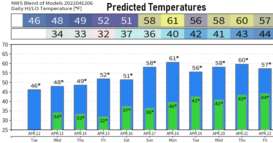
At this time, snow levels Wednesday afternoon through Thursday are expected to stay above 1000'. Will have to keep an eye on Friday night and Saturday morning - some new data coming in hints the air will be cold enough for snow. Easter Sunday looks dry with a warming trend, then warmer next week with 2-3 storms.
Snow pack got a big boost. Many areas of the Cascades got over a foot of new snow so far. Saturday our region of the snow pack was at 69% of average, today we're at 83%. Normal high and low temp: 62/38.