
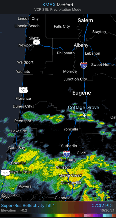
A cut-off low pressure system currently centered approx 200 miles offshore of the far Northern California coast is causing instability in Oregon from about Eugene southward. This triggered one lightning strike here in Cottage Grove at 7:39 this morning. The term "cut-off" means that the system is detached, or "cut-off," from the jet stream and sort of wobbles around with a mind of its own. Here's the radar imagery from this morning - look for the little white lightning bolt near Cottage Grove:
Shower and thunderstorm chances will continue through this evening, with much of the overnight expected to be dry under partly to mostly cloudy skies. Winds are expected to be light, but could become gusty around any thunderstorm. Note that the Northern Lights are very active and it's possible we could see a little show to the north tonight if skies were otherwise expected to be clear.
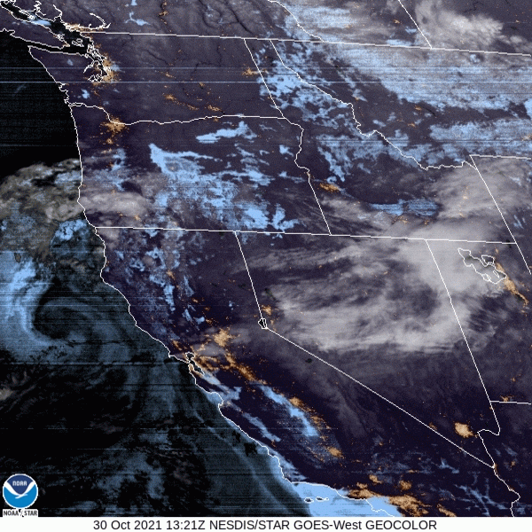
Check out the satellite image: Look for the "spin" offshore of the Northern California coast - this is the "cut-off" low pressure system that's spinning clouds and instability into our area
Sunday (Halloween): Small shower chances will exist during the morning, but the afternoon and early night still looks dry with very light winds for trick-or-treating with (6pm temperature around 50-52, 8pm temperature near 47-50).
Monday through next weekend: The weather pattern will remain active with 3-4 storm systems passing through. First system arrives Monday morning, during the predawn hours. Expect about a 1/4-1/3" of rainfall on Monday. Monday night and Tuesday look mainly dry (but can't rule out an isolated shower Tuesday afternoon). Rain will develop on Wednesday afternoon or evening and continue through Thursday (expect ~ 1/2" of rain with this system). Thursday night through Friday morning will likely be dry, then the next system brings another round of rain (1/2"-1") Friday evening or night through Saturday (Nov 6) and possibly into Sun Nov 7. Temperatures through next weekend will vary from the mid 50's to low 60's for the highs and upper 30's to mid 40's for the lows. Frost/freeze unlikely. Night/morning fog between systems.
Bottom line: None of these systems are expected to be strong, so just your typical Oregon weather over the next week with no wind concerns (just your typical gusts up to 15-20 mph as each front passes through). Snow levels will vary at 6000-7000' through Thursday morning, then 5000-6000' Thursday night through next weekend. Total combined rainfall through next weekend will be 3/4"-1.50".
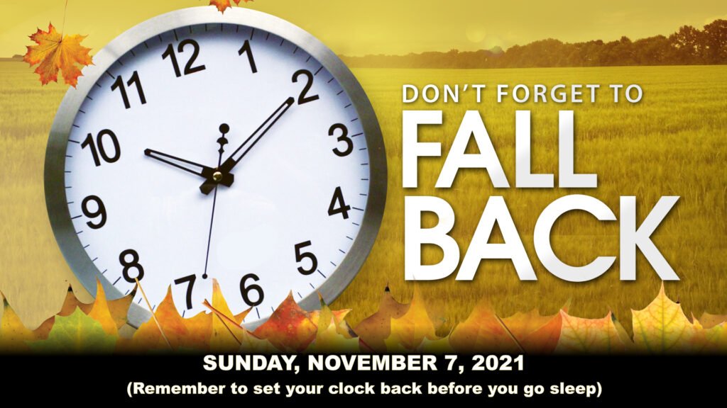
Daylight Savings: Next Sunday November 7, clocks go BACK one hour, as Daylight Savings Time ends. It's also suggested to test your smoke alarms to ensure they're operational.
Rain totals: As of 11:00am, we've recorded 4.52" of rain so far for October. Normal for the entire month is 3.67". Therefore, we're off to a good start for the 2021-22 water year, which began on October 1st. Keep your finger's crossed. There's no current signals of both the pattern and models that below normal rainfall will occur over the next 30-45 days. In other words, normal to slightly above normal precipitation is expected through November.