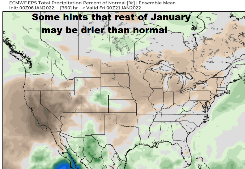
Thurs Jan 6: Last of the series of storms will affect the area this evening through Friday evening. Although we might see some gusts to 30 or 35 mph, winds aren't expected to be as strong as the Sun-Mon system where the coast saw 80+mph winds and 35-45 mph across the local area. Right now it looks dry Friday night through Wednesday.
![]() RAIN
RAIN ![]() will develop this evening between 7-11pm and change over to showers around noon on Friday. Showers end by 10pm Friday. Total rainfall 1/2-1".
will develop this evening between 7-11pm and change over to showers around noon on Friday. Showers end by 10pm Friday. Total rainfall 1/2-1".
![]() WINDS
WINDS ![]() It's now looking like we can see some gusts up to 30 or 35mph IF winds above us mix down to the surface as expected. Strongest winds 1am to 8am Friday, gusts up to 30 or 35 mph possible. Otherwise, gusts to 25 mph this afternoon through Friday morning.
It's now looking like we can see some gusts up to 30 or 35mph IF winds above us mix down to the surface as expected. Strongest winds 1am to 8am Friday, gusts up to 30 or 35 mph possible. Otherwise, gusts to 25 mph this afternoon through Friday morning.
![]() SNOW
SNOW ![]() Snow levels through Friday morning will be quite high: above 5000' today, 4000' Friday morning, then 3500' Friday afternoon and early night.
Snow levels through Friday morning will be quite high: above 5000' today, 4000' Friday morning, then 3500' Friday afternoon and early night.
![]() HAZARDS
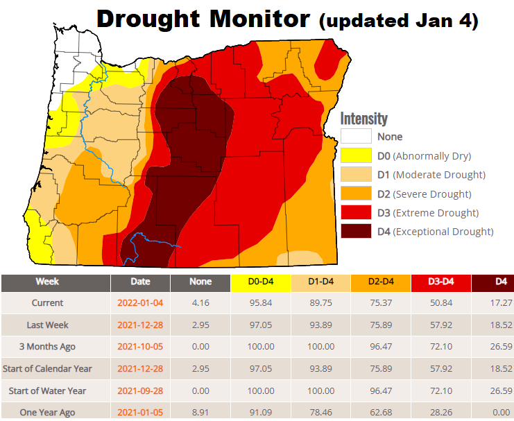
HAZARDS![]() Soils are saturated from all the rain this week and rivers are already running high. Higher snow levels will increase lower elevation snow melt, adding more water into the rivers. Minor flooding into Saturday morning remains possible at the spots that typically flood. In-town flooding is unlikely. Possibility of a downed tree or broken limbs will exist, especially IF winds over 30 mph occur. Hills & mountains may see higher winds to 35-45 mph.
Soils are saturated from all the rain this week and rivers are already running high. Higher snow levels will increase lower elevation snow melt, adding more water into the rivers. Minor flooding into Saturday morning remains possible at the spots that typically flood. In-town flooding is unlikely. Possibility of a downed tree or broken limbs will exist, especially IF winds over 30 mph occur. Hills & mountains may see higher winds to 35-45 mph.