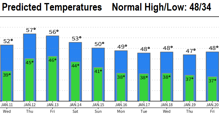
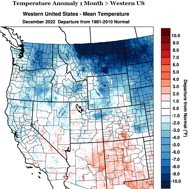
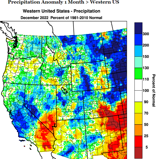
Four to five storm systems will bring up to 2-3" of rainfall over the next 10-days (through Jan 19). We're currently behind by almost 5" (as of the start of the water year on Oct 1, we've recorded 15.07" of precipitation; normal to date is 19.93"). No chances for lowland snow through Jan 17. Strong winds are not expected over the next 7-days, but we'll see gusts of 15-25 mph at times as each system passes through (no biggie).
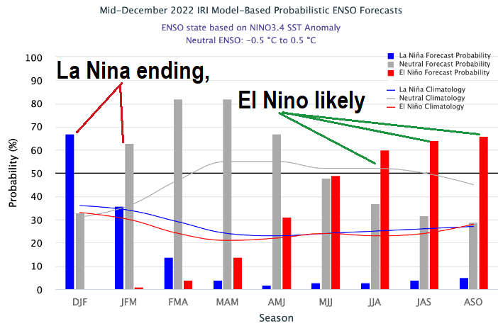
Lots of informational charts/maps as you scroll below. La Nina is weakening (currently at weak strength) and is expected to dissipate over the next 30-45 days. This weaking will likely continue to throw some curve balls our way through the rest of winter and right on through spring. After La Nina dissipates, I expect El Nino (anomalously warm Sea Surface Temperatures) to quickly develop since oceanic data indicates warm water moving into key parts of the Equatorial Pacific where El Nino and La Nina occur. Most data hint at El Nino peaking at moderate strength next Winter, which, historically, give us better odds for above normal precipitation (conversely, weak and strong El Nino's favor below normal precip).