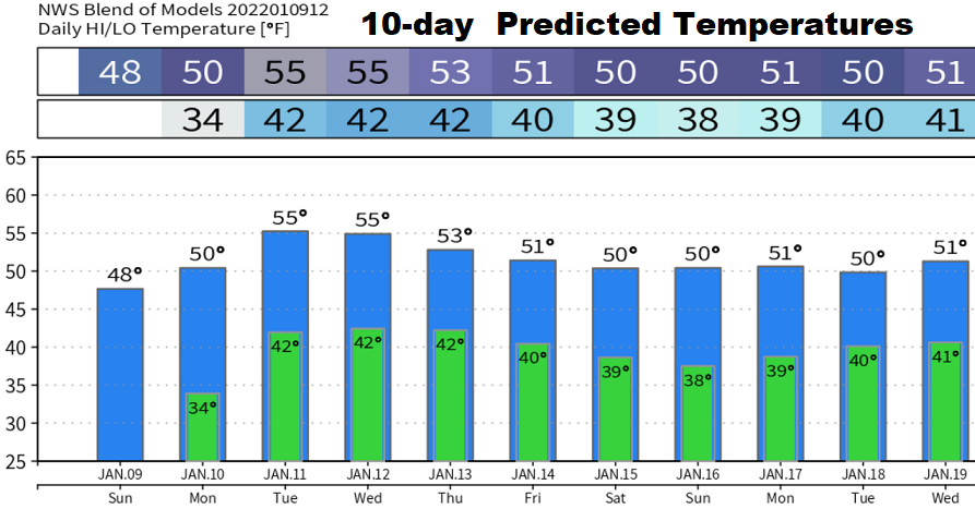
It seemed as if the rain would never stop, but here we are in a dry pattern for a change. It feels good to finally see the sun, doesn't it? A small chance of a light shower or two on Monday, then better rain chances will exist on Wednesday night and Thursday (less than 1/4"). Perhaps a few showers on Saturday and again early the following week, but don't hold your breath. After abundant sunshine today (Sunday), the rest of the week will have a mix of sun/clouds to mostly cloudy skies at times, along with the possibility of night/morning dense fog. Strong and blocking high pressure across the west and parts of the North Pacific Ocean will maintain a generally dry pattern through about January 20.
January is our third wettest month (6.73"), only behind November (6.92") and December (7.37"). As of January 9, 2022, we've recorded 23.07" of precipitation since the start of the water year on October 1st (water year runs Oct 1-Sept 30). Normal to date is 19.97", so we're at 116% of normal to date. Long range data hints that the dry pattern may break down and revert back to wet towards the end of January (around Jan 25). Even if we only get another inch of rain for the rest of January, we'll still be within 5% of normal precipitation at the end of the month.