Just got back home late yesterday evening from an out of state trip this past week and had limited access for posts.
Lots of rain since yesterday! As of 11:00am Sunday, in the past 24-hrs local weather stations have recorded 2.47"-3.34" of rain so far. Looks like another 1" through Monday, most of which occurs before sunrise (Monday).
Dry/mostly dry all of Tuesday then another two low pressure systems pass through Wed-Fri, adding another 0.75-1.50" of combined rainfall. Next weekend Sat-Sun looks mainly dry right but don't be surprised if a few light showers gets added into the forecast (not a washout).
Why all the rain? Play the satellite GIF and look for the continuous line of clouds that runs from just north of Hawaii and aimed into the PacNW. What you're seeing is a massive amount of moisture that extends from the subtropics (where lots of moisture exists) and is aimed directly into our region. The old term for this was "Pineapple Express Connection" and the new term is "Atmospheric River." So basically think of it as a "river' of moisture overhead that has nowhere else to go but down onto us.
RAIN TOTALS: As of 11:00am Sunday, total rainfall for March has been 6.30"-7.56". Normal for all of March is 5.21". Normal for the entire rainfall year that runs Oct 1-Sept 30 is 46.36" and area weather stations have recorded 42.94-46.36" so by Sept 30 we will be way above 100%!
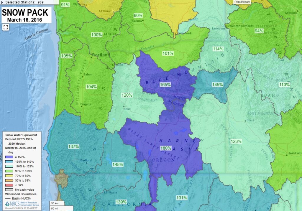
SNOW PACK is above 100% across Oregon and most of the PacNW. It should be noted that "Atmospheric Rivers" are a mild air mass so snow levels are usually high and the copious rain accelerates lower elevation snow melt which adds to flooding problems from creeks, streams, rivers.
Subscribe to receive updates when we post weather and preparedness updates to our blog. You can elect immediate, daily, or weekly emails. We anticipate a fairly low volume - 3 to 5 posts per week.