A dusting of snow is possible sometime between Saturday night and about 10am Sunday. This system will be fast moving and doesn't have a lot of moisture, so no snowmageddon. Biggest impact will be very cold temperatures. Breezy Sunday/Monday, so it will feel much colder than actual temperature.
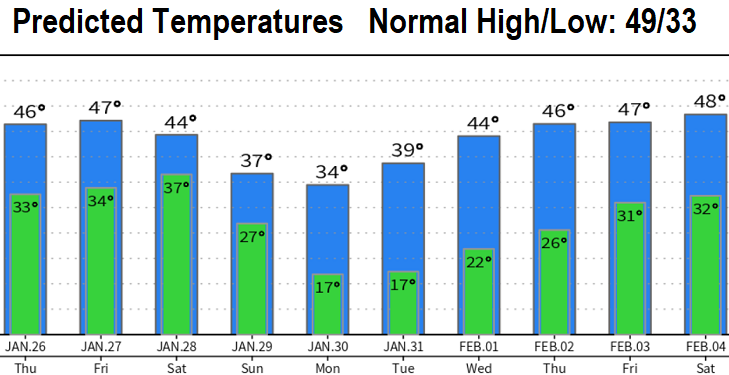
Details: On Friday, cold system #1 comes through with just some light showers and snow levels above 2500'. No wind concerns. Saturday night into Sunday morning, much colder system #2 with modified Arctic Air passes through. Snow levels possibly down to valley floor, but mostly above 800' (4-6" possible in the Cascades). Precipitation threat looks to be completely done with by about noon Sunday. Winds Sunday and Monday can gust up to 15-25 mph at times, making it feel much colder than it actually is. Take a look at the icy cold predicted temperatures. Main hazards from all this will be the icy roads and sidewalks. These temperatures will be deadly for pets left outside.